Former Salvation Army City Temple, Westgate Road
Introduction
The photograph on this page of Former Salvation Army City Temple, Westgate Road by Andrew Curtis as part of the Geograph project.
The Geograph project started in 2005 with the aim of publishing, organising and preserving representative images for every square kilometre of Great Britain, Ireland and the Isle of Man.

There are currently over 7.5m images from over 14,400 individuals and you can help contribute to the project by visiting https://www.geograph.org.uk
Former Salvation Army City Temple, Westgate Road
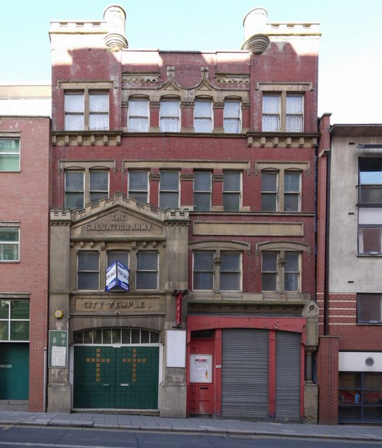
Image: © Andrew Curtis Taken: 8 Mar 2010
Closed in 2008 due to cost of upkeep after nearly 120 years. Read some of its history here http://www.chroniclelive.co.uk/north-east-news/history-newcastle-north-east/remember-when/2008/10/22/on-the-march-after-120-years-72703-22083898/
Images are licensed for reuse under creativecommons.org/licenses/by-sa/2.0
Image Location
Latitude
54.97075
Longitude
-1.621631