Bottom end of Bath Lane
Introduction
The photograph on this page of Bottom end of Bath Lane by Robert Graham as part of the Geograph project.
The Geograph project started in 2005 with the aim of publishing, organising and preserving representative images for every square kilometre of Great Britain, Ireland and the Isle of Man.

There are currently over 7.5m images from over 14,400 individuals and you can help contribute to the project by visiting https://www.geograph.org.uk
Bottom end of Bath Lane
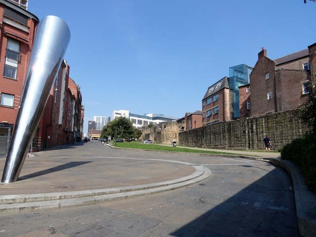
Image: © Robert Graham Taken: 27 Aug 2019
In the west end of Newcastle city centre. This is the southern end of Bath Lane where it joins Westgate Road. Running along the right hand side of the street is a long section of the original 13th century town walls of Newcastle. On the left is the striking abstract sculpture "Ever Changing", by Ellis O'Connell, 2005. This was commissioned as part of the Grainger Town Project, when this area of the city was revamped. The sculpture occupies the site of the now demolished Waterloo pub.
Images are licensed for reuse under creativecommons.org/licenses/by-sa/2.0
Image Location
Latitude
54.970748
Longitude
-1.62085