
IMAGES TAKEN NEAR TO
Belvedere Gardens, NEWCASTLE UPON TYNE, NE12 9PG
Introduction
This page details the photographs taken nearby to Belvedere Gardens, NE12 9PG by members of the Geograph project.
The Geograph project started in 2005 with the aim of publishing, organising and preserving representative images for every square kilometre of Great Britain, Ireland and the Isle of Man.

There are currently over 7.5m images from over14,400 individuals and you can help contribute to the project by visiting https://www.geograph.org.uk
Image Map
Images are licensed for reuse under creativecommons.org/licenses/by-sa/2.0
Notes
- Clicking on the map will re-center to the selected point.
- The higher the marker number, the further away the image location is from the centre of the postcode.
Image Listing (37 Images Found)
Images are licensed for reuse under creativecommons.org/licenses/by-sa/2.0
Image
Details
Distance
1
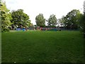
Benton Quarry Park, Benton
A grassed area in Benton Quarry Park.
Image: © Graham Robson
Taken: 7 May 2020
0.08 miles
2
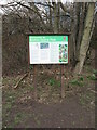
Sign, Benton Quarry Park, Whitley Road, Benton
The park is located on the site of the former Benton Quarry, shown on the Ordnance Survey Six-Inch map of the area published in 1898 as being in full service, and on the 1921-published edition as being disused. As an area subsequently landfilled it was considered unfit to build on, thus securing it as an invaluable area of green space. The area has been used as a park since 1974. For a selection of detailed free to download walking routes in the area visit www.northtynesidewalks.co.uk
Image: © Geoff Holland
Taken: 16 Mar 2021
0.08 miles
3
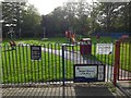
Play park, Benton Quarry Park, Benton
A play park for children near the main entrance into Benton Quarry Park. As part of their response to the COVID-19 pandemic which affected the UK from the early part of 2020 the government instructed all children's play parks to be closed to reduce the risk of spreading the infectious disease through children touching the equipment and getting close to each other.
Image: © Graham Robson
Taken: 7 May 2020
0.08 miles
4
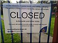
Closure sign, Benton Quarry Park, Benton
A noticed attached to the gate into the children's play park in Benton Quarry Park. The sign informs users that the park is closed following public health advice from the government. The government's response to the COVID-19 pandemic which struck the UK in the first part of 2020 included the closure of all children's play areas in order to limit contact between children, the equipment, and each other, to try and reduce the risk of catching the virus.
Image: © Graham Robson
Taken: 7 May 2020
0.08 miles
5

Car park at Benton Quarry Park, Benton
The entrance to car parking area at Benton Quarry Park off Whitley Road. As part of the government's response to the COVID-19 pandemic which struck in the early months of 2020 laws were introduced prohibiting travel for all but essential reasons. Because of this North Tyneside Council closed their car parks to discourage recreational travel. The instruction to 'Stay at Home, Protect the NHS and Save Lives was widely promoted across the country to reinforce the government's core advice.
Image: © Graham Robson
Taken: 7 May 2020
0.10 miles
6
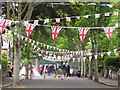
A Street Party in Newcastle, 2012
Celebrating the Diamond Jubilee of Queen Elizabeth II
Image: © Andrew Tryon
Taken: 3 Jun 2012
0.12 miles
7

Housing development, Whitley Road, Benton
A housing development on Whitley Road in Benton, being constructed by Taylor Wimpey.
Image: © Graham Robson
Taken: 19 Feb 2017
0.13 miles
8
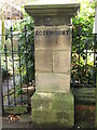
Pier, 'Rosemount', 4 West Avenue, Benton
This original pier belongs to 4 West Avenue, one of a pair of large semi-detached homes which retain many of their original features and character https://www.geograph.org.uk/photo/6779178. The properties were built in the late 1890s. For a selection of detailed free to download walking routes in the area visit www.northtynesidewalks.co.uk
Image: © Geoff Holland
Taken: 16 Mar 2021
0.14 miles
9
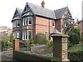
3 & 4 West Avenue, Benton
These two large semi-detached homes, part of a group of four, retain many of their original features and character, and were built in the late 1890s by Lewis Lundi of Rock Villa, Jesmond, who also owned a number of other properties nearby. When he died in November 1905, ownership passed to his son, Frederico George Lundi, who lived at 5 West Avenue, a property which no longer exits. For a selection of detailed free to download walking routes in the area visit www.northtynesidewalks.co.uk
Image: © Geoff Holland
Taken: 16 Mar 2021
0.14 miles
10
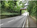
Station Road, Benton
Looking along Station Road. Benton Station is located a short distance to the left of the railway bridge which can be seen crossing the road ahead.
Image: © Graham Robson
Taken: 21 Aug 2016
0.14 miles