1
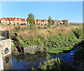
Rocks in the Park
In a recreation ground along Montagu Road, Edmonton.
Image: © Des Blenkinsopp
Taken: 9 Oct 2018
0.04 miles
2
Salmon's Brook in Edmonton (4)
This is a view looking upstream from the Montagu Road culvert showing the new flood defence walls on either side of the brook. Beyond the wall on the left is the Tottenham Park Cemetery. On the right are the housing blocks in Barrowfield Close, which was once the site of the Edmonton Stadium (greyhound racing).
Image: © Nigel Cox
Taken: 5 May 2016
0.05 miles
3
Tottenham Park Cemetery, Upper Edmonton
Used primarily for Muslim burials.
Image: © Jim Osley
Taken: 11 Jun 2017
0.07 miles
4
Salmons Brook
Salmons Brook is a small tributary of the River Lea which has a history of flooding. https://en.wikipedia.org/wiki/Salmons_Brook The area here has paths and a few trees and functions as a bit of a park for most of the time, but it is enclosed by earth banks and is designed to contain flood water should the need arise.
Image: © Des Blenkinsopp
Taken: 9 Oct 2018
0.10 miles
5
Cemetery chapel, Tottenham Park Cemetery
Disused and dilapidated.
Image: © Jim Osley
Taken: 11 Jun 2017
0.11 miles
6
Salmon's Brook in Edmonton (3)
This is a view looking upstream showing the new flood defence walls on either side of the brook. Beyond the higher wall on the left is the Jewish Federation Cemetery.
Image: © Nigel Cox
Taken: 5 May 2016
0.15 miles
7
Salmon's Brook in Edmonton (5)
This is a view looking upstream from the railway culvert. The whole area on either side of the brook here has been landscaped to provide temporary water storage areas in a flood event.
Image: © Nigel Cox
Taken: 5 May 2016
0.15 miles
8
Flood Storage by Salmons Brook
Salmons Brook, a small tributary of the Lea, flows through this undeveloped area which has been embanked to hold flood water during heavy rainfall events. Flooding has occurred around here in the past.
Image: © Des Blenkinsopp
Taken: 9 Oct 2018
0.16 miles
9
Horse on the Lawn, Montagu Road
This splendid metal horse is in front of a new crescent of houses.
I can find nothing on the web about it.
Image: © Des Blenkinsopp
Taken: 9 Oct 2018
0.18 miles
10
Upper Edmonton: Railway line
Viewed looking in the direction of Ponders End station from the Pegamoid Road foot crossing of the railway, with the A1055 Meridian Way (North - South Route) to the right.
Image: © Nigel Cox
Taken: 30 Jan 2007
0.18 miles


