IMAGES TAKEN NEAR TO
N7 0JH
Introduction
This page details the photographs taken nearby to N7 0JH by members of the Geograph project.
The Geograph project started in 2005 with the aim of publishing, organising and preserving representative images for every square kilometre of Great Britain, Ireland and the Isle of Man.

There are currently over 7.5m images from over14,400 individuals and you can help contribute to the project by visiting https://www.geograph.org.uk
Image Map
Images are licensed for reuse under creativecommons.org/licenses/by-sa/2.0
Notes
- Clicking on the map will re-center to the selected point.
- The higher the marker number, the further away the image location is from the centre of the postcode.
Image Listing (95 Images Found)
Images are licensed for reuse under creativecommons.org/licenses/by-sa/2.0
Image
Details
Distance
1
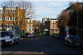
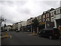
Hilldrop Crescent from Leighton Road
Image: © Christopher Hilton
Taken: 19 Jan 2017
0.01 miles
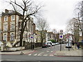
2
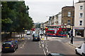
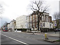
Brecknock Road
Viewed from the top deck of a 390 bus en-route to Notting Hill Gate, another 390 on the return journey to Archway can be seen bearing left onto Leighton Road as it enters the one way system at this point.
Brecknock Road was named in 1869 after the Marquis of Camden who was also the Earl of Brecknock. Further down the hill are the traffic lights at the junction with Camden Road.
Image: © Martin Addison
Taken: 7 Jul 2010
0.04 miles
3
Looking into Leighton Road from Hilldrop Crescent
Image: © Christopher Hilton
Taken: 19 Jan 2017
0.04 miles
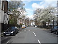
4
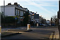
Terraced houses, Leighton Road, NW5
Shows the location of Image
Image: © Mike Quinn
Taken: 12 May 2009
0.05 miles
6
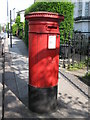
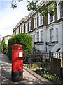
Victorian postbox, Leighton Road, NW5
Image: © Mike Quinn
Taken: 12 May 2009
0.07 miles
7
Hilldrop Crescent, near Holloway
Hilldrop Crescent is a residential road in the inner suburbs of north London.
Image: © Malc McDonald
Taken: 26 Jan 2019
0.07 miles
9
Camden Road, near Holloway
Houses facing onto Camden Road, near Holloway. Camden Road forms part of the A503.
Image: © Malc McDonald
Taken: 26 Jan 2019
0.08 miles
10
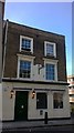
The Admiral Mann pub (as was)
Once the only MacMullens pub in inner London. Closed about a decade ago and now seems to be used for temporary housing. In the 1970's the internal walls were painted, in a primitive fashion, with scenes from a naval battle (possibly of Trafalgar).
Image: © John Kingdon
Taken: 10 Jul 2017
0.09 miles