Brecknock Road
Introduction
The photograph on this page of Brecknock Road by Martin Addison as part of the Geograph project.
The Geograph project started in 2005 with the aim of publishing, organising and preserving representative images for every square kilometre of Great Britain, Ireland and the Isle of Man.

There are currently over 7.5m images from over 14,400 individuals and you can help contribute to the project by visiting https://www.geograph.org.uk
Brecknock Road
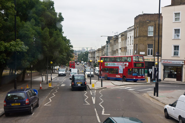
Image: © Martin Addison Taken: 7 Jul 2010
Viewed from the top deck of a 390 bus en-route to Notting Hill Gate, another 390 on the return journey to Archway can be seen bearing left onto Leighton Road as it enters the one way system at this point. Brecknock Road was named in 1869 after the Marquis of Camden who was also the Earl of Brecknock. Further down the hill are the traffic lights at the junction with Camden Road.
Images are licensed for reuse under creativecommons.org/licenses/by-sa/2.0
Image Location
Latitude
51.550871
Longitude
-0.130181