IMAGES TAKEN NEAR TO
Shepherds Hill, LONDON, N6 5RR
Introduction
This page details the photographs taken nearby to Shepherds Hill, N6 5RR by members of the Geograph project.
The Geograph project started in 2005 with the aim of publishing, organising and preserving representative images for every square kilometre of Great Britain, Ireland and the Isle of Man.

There are currently over 7.5m images from over14,400 individuals and you can help contribute to the project by visiting https://www.geograph.org.uk
Image Map
Images are licensed for reuse under creativecommons.org/licenses/by-sa/2.0
Notes
- Clicking on the map will re-center to the selected point.
- The higher the marker number, the further away the image location is from the centre of the postcode.
Image Listing (99 Images Found)
Images are licensed for reuse under creativecommons.org/licenses/by-sa/2.0
Image
Details
Distance
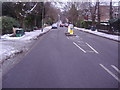
1
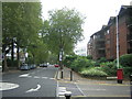
Shepherd's Hill, Highgate
Looking downhill towards Crouch End, at the junction with Stanhope Road.
Image: © Christopher Hilton
Taken: 21 Sep 2015
0.02 miles
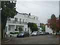
2
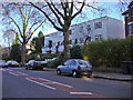
Shepherds Hill, Highgate
The last white house on the right is 44, where my grandparents lived from 1955-75 while it still had two floors.
Image: © David Howard
Taken: 21 Jan 2006
0.02 miles
3
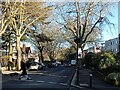
Shepherds Hill, Highgate
A sunny mid-winter day.
Image: © Bikeboy
Taken: 2 Jan 2025
0.02 miles
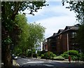
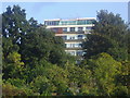
5
Modernist flats, Broughton Gardens
The area along Shepherd's Hill between Highgate and Crouch End is characterised by a mix of Victoria villas and modern blocks of flats that presumably replace villas demolished at some point in the past.
Image: © Christopher Hilton
Taken: 21 Sep 2015
0.04 miles
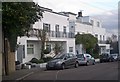
6
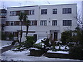
Modernist houses on Shepherds Hill
These houses were originally included in Broughton Gardens, but changed to their actual location in Shepherds Hill around 1960. Both have had a second floor added on the flat roof.
Image: © David Howard
Taken: 23 Dec 2010
0.04 miles
7
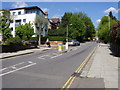
Stanhope Road
Stanhope Road passing Stanhope Gardens and Hurst Avenue
Image: © Shaun Ferguson
Taken: 29 Apr 2009
0.04 miles
8
Shepherd's Hill
Shepherd's Hill runs between Highgate and Crouch End. Stanhope Road is on the right here.
Image: © Marathon
Taken: 17 Jun 2015
0.04 miles
9
Stanhope Road
Looking towards the Hornsey Lane end
Image: © David Howard
Taken: 23 Dec 2010
0.05 miles
10
Rear of flats on Shepherds Hill
The allotments run most of the length of this side of the road behind the buildings.
Image: © David Howard
Taken: 4 Sep 2013
0.08 miles