IMAGES TAKEN NEAR TO
Shepherds Hill, LONDON, N6 5RJ
Introduction
This page details the photographs taken nearby to Shepherds Hill, N6 5RJ by members of the Geograph project.
The Geograph project started in 2005 with the aim of publishing, organising and preserving representative images for every square kilometre of Great Britain, Ireland and the Isle of Man.

There are currently over 7.5m images from over14,400 individuals and you can help contribute to the project by visiting https://www.geograph.org.uk
Image Map
Images are licensed for reuse under creativecommons.org/licenses/by-sa/2.0
Notes
- Clicking on the map will re-center to the selected point.
- The higher the marker number, the further away the image location is from the centre of the postcode.
Image Listing (57 Images Found)
Images are licensed for reuse under creativecommons.org/licenses/by-sa/2.0
Image
Details
Distance
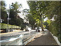
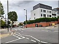
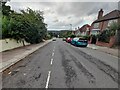
2
Stanhope Road, Highgate
The junction here at the edge of Shepherds Hill has been meaninglessly tinkered with by the council despite it now being used as a bus route.
Image: © David Howard
Taken: 4 Sep 2013
0.03 miles
3
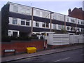
Modern houses on Coolhurst Road
These town houses would have been built some time between the late 60s and early 70s going by the design.
Image: © David Howard
Taken: 16 Feb 2012
0.04 miles
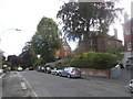
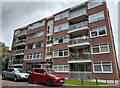
5
New flats on the corner of Shepherds Hill and Stanhope Road
I think these went up in the last few years before 2013. The Victorian house next door is the only one remaining on the block.
Image: © David Howard
Taken: 4 Sep 2013
0.04 miles
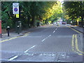
6
Crossroads on Wolseley Road, Crouch End
Shepherds Hill becomes Wolseley Road when it changes postcodes, which is standard within London but far from compulsory.
Image: © David Howard
Taken: 28 Sep 2021
0.04 miles
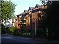
8
Melior Court, Highgate
Shepherds Hill was originally built with large Victorian houses, but from the late 50s to 80s most were replaced by very similar flats, but very well designed. As my grandparents lived opposite till 1975 I knew it well and my grandpa photographed some of the gradual changes since the mid 50s.
Image: © David Howard
Taken: 28 Sep 2021
0.06 miles
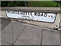
9
Montenotte Road, Crouch End
Looking towards Alexandra Park
Image: © David Howard
Taken: 28 Sep 2021
0.07 miles
10
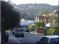
View from Montenotte Road, Hornsey
Looking towards the east side of Muswell Hill and Alexandra Park. Highgate Wood School is at the end of the road.
Image: © David Howard
Taken: 4 Sep 2013
0.07 miles