IMAGES TAKEN NEAR TO
Shepherds Hill, LONDON, N6 5RG
Introduction
This page details the photographs taken nearby to Shepherds Hill, N6 5RG by members of the Geograph project.
The Geograph project started in 2005 with the aim of publishing, organising and preserving representative images for every square kilometre of Great Britain, Ireland and the Isle of Man.

There are currently over 7.5m images from over14,400 individuals and you can help contribute to the project by visiting https://www.geograph.org.uk
Image Map
Images are licensed for reuse under creativecommons.org/licenses/by-sa/2.0
Notes
- Clicking on the map will re-center to the selected point.
- The higher the marker number, the further away the image location is from the centre of the postcode.
Image Listing (54 Images Found)
Images are licensed for reuse under creativecommons.org/licenses/by-sa/2.0
Image
Details
Distance
3
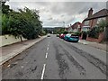
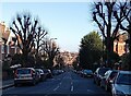
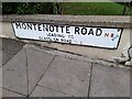
Montenotte Road, Crouch End
Looking towards Alexandra Park
Image: © David Howard
Taken: 28 Sep 2021
0.03 miles
4
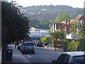
View from Montenotte Road, Hornsey
Looking towards the east side of Muswell Hill and Alexandra Park. Highgate Wood School is at the end of the road.
Image: © David Howard
Taken: 4 Sep 2013
0.04 miles
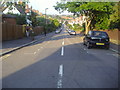
5
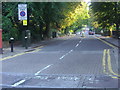
Stanhope Road, Highgate
The junction here at the edge of Shepherds Hill has been meaninglessly tinkered with by the council despite it now being used as a bus route.
Image: © David Howard
Taken: 4 Sep 2013
0.04 miles
6
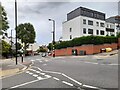
Crossroads on Wolseley Road, Crouch End
Shepherds Hill becomes Wolseley Road when it changes postcodes, which is standard within London but far from compulsory.
Image: © David Howard
Taken: 28 Sep 2021
0.04 miles
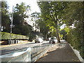
7
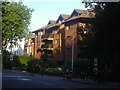
New flats on the corner of Shepherds Hill and Stanhope Road
I think these went up in the last few years before 2013. The Victorian house next door is the only one remaining on the block.
Image: © David Howard
Taken: 4 Sep 2013
0.04 miles
8
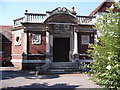
Borough of Hornsey War Memorial
This memorial to the 1st World War is situated on Park Road, N8, in the grounds of the now abandoned Hornsey Memorial Hospital.
The square itself is dominated by sports facilities such as Park Road Swimming Pool and numerous cricket grounds and tennis courts fields including those of the North Middlesex Sports Club and Highgate Sports Club
Image: © Michael Green
Taken: 10 Jul 2005
0.05 miles