IMAGES TAKEN NEAR TO
Corsica Street, LONDON, N5 1JY

Introduction

This page details the photographs taken nearby to Corsica Street, N5 1JY by members of the Geograph project.

The Geograph project started in 2005 with the aim of publishing, organising and preserving representative images for every square kilometre of Great Britain, Ireland and the Isle of Man.

There are currently over 7.5m images from over14,400 individuals and you can help contribute to the project by visiting https://www.geograph.org.uk

Image Map


Images are licensed for reuse under creativecommons.org/licenses/by-sa/2.0
Notes
  • Clicking on the map will re-center to the selected point.
  • The higher the marker number, the further away the image location is from the centre of the postcode.

Image Listing (170 Images Found)

Images are licensed for reuse under creativecommons.org/licenses/by-sa/2.0
  • ...
Image
Details
Distance
1
Gallia Road, Highbury
Image: © Chris Whippet Taken: 12 Jul 2015
0.02 miles
2
Calabria Road, Highbury
Image: © Chris Whippet Taken: 12 Jul 2015
0.04 miles
3
Exercising the dogs, Highbury Fields
Highbury Fields is a 30 acre open space in an up-market residential area and has been a public park since 1885. It has a range of recreational facilities and provides plenty of scope for human and canine activities.
Image: © Natasha Ceridwen de Chroustchoff Taken: 13 Nov 2007
0.05 miles
4
Listed row, Highbury Place
Image: © N Chadwick Taken: 27 Mar 2022
0.05 miles
5
Highbury Place, Highbury
These houses on Highbury Place, overlooking Highbury Fields, date from the 1770s and were amongst the first new buildings that were to transform Highbury from a rural hamlet into a London suburb.
Image: © Stephen McKay Taken: 26 Nov 2010
0.05 miles
6
Highbury Place, Highbury
Apart from the row of parked cars, this scene cannot have changed much since these houses were built in the 1770s.
Image: © Stephen McKay Taken: 26 Nov 2010
0.05 miles
7
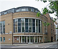
Highbury Baptist Church
Built in 2002-2003 to replace an earlier church on the same site. A brief history of the church may be found at this https://www.highburybaptistchurch.org/Groups/177158/Highbury_Baptist_Church/About_Us/Our_History/Our_History.aspx
Image: © Jim Osley Taken: 25 May 2018
0.06 miles
8
Baalbec Road, Highbury
Image: © David Howard Taken: 13 Jun 2014
0.06 miles
9
Highbury Place at the junction of Baalbec Road
Overlooking Highbury Fields
Image: © David Howard Taken: 13 Jun 2014
0.07 miles
10
Harecourt United Reformed Church, St Paul's Road
Replaces a church built in 1855 and destroyed by fire in 1982. The foundation stone for the 1855 church has been incorporated into the new building.
Image: © Jim Osley Taken: 28 Apr 2017
0.07 miles
  • ...