IMAGES TAKEN NEAR TO
Ossian Road, LONDON, N4 4EA
Introduction
This page details the photographs taken nearby to Ossian Road, N4 4EA by members of the Geograph project.
The Geograph project started in 2005 with the aim of publishing, organising and preserving representative images for every square kilometre of Great Britain, Ireland and the Isle of Man.

There are currently over 7.5m images from over14,400 individuals and you can help contribute to the project by visiting https://www.geograph.org.uk
Image Map
Images are licensed for reuse under creativecommons.org/licenses/by-sa/2.0
Notes
- Clicking on the map will re-center to the selected point.
- The higher the marker number, the further away the image location is from the centre of the postcode.
Image Listing (110 Images Found)
Images are licensed for reuse under creativecommons.org/licenses/by-sa/2.0
Image
Details
Distance
1
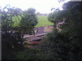
Ossian Road from Parkland Walk
Crouch End covered reservoir is opposite
Image: © David Howard
Taken: 5 Jul 2012
0.05 miles
3
Mount Pleasant Villas
Seen from The Parkland Walk - previously the GNR's Finsbury Park to Alexandra Palace branch. The large green area to the centre right of the photo is a covered reservoir built some time prior to 1885. The railway line had a signal box near here called 'Reservoir' prior to the opening of Stroud Green station.
Image: © Martin Addison
Taken: 28 Jan 2011
0.06 miles
5
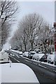
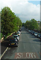
Snow on cars - the kind of snow that's good for making snowballs
Image: © Slbs
Taken: Unknown
0.07 miles
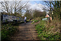
7
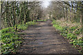
Parkland Walk near Crouch End
This section of Parkland Walk is also on the route of the Capital Ring.
Image: © Malc McDonald
Taken: 13 Aug 2023
0.07 miles
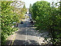
9
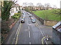
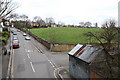
View from Parkland Walk, looking north
The road here is Mount Pleasant Villas, running into Mount View Road in the distance. On the right, Ossian Road enters, while the greensward is the top of a covered reservoir.
Image: © Dr Neil Clifton
Taken: 7 Jan 2012
0.08 miles
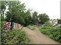
10
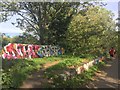
Graffiti at Crouch Hill
The old railway line is now a footpath, the railway bridge a graffiti artists' canvas.
Image: © Alan Hughes
Taken: 13 Oct 2018
0.08 miles