Mount Pleasant Villas
Introduction
The photograph on this page of Mount Pleasant Villas by Martin Addison as part of the Geograph project.
The Geograph project started in 2005 with the aim of publishing, organising and preserving representative images for every square kilometre of Great Britain, Ireland and the Isle of Man.

There are currently over 7.5m images from over 14,400 individuals and you can help contribute to the project by visiting https://www.geograph.org.uk
Mount Pleasant Villas
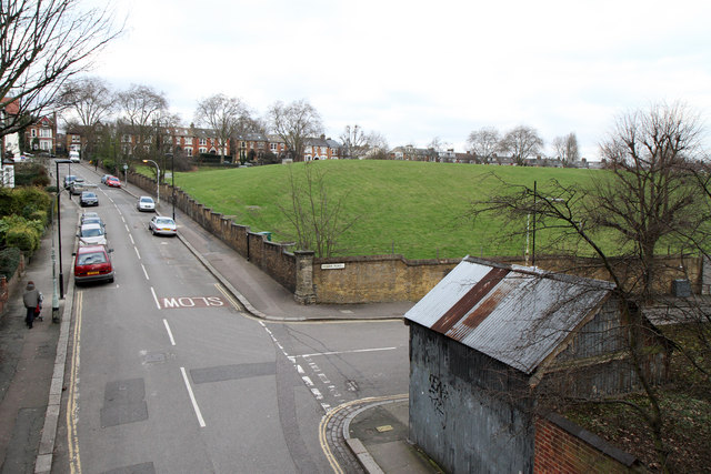
Image: © Martin Addison Taken: 28 Jan 2011
Seen from The Parkland Walk - previously the GNR's Finsbury Park to Alexandra Palace branch. The large green area to the centre right of the photo is a covered reservoir built some time prior to 1885. The railway line had a signal box near here called 'Reservoir' prior to the opening of Stroud Green station.
Images are licensed for reuse under creativecommons.org/licenses/by-sa/2.0
Image Location
Latitude
51.574473
Longitude
-0.115935