IMAGES TAKEN NEAR TO
Thorpedale Road, LONDON, N4 3BW
Introduction
This page details the photographs taken nearby to Thorpedale Road, N4 3BW by members of the Geograph project.
The Geograph project started in 2005 with the aim of publishing, organising and preserving representative images for every square kilometre of Great Britain, Ireland and the Isle of Man.

There are currently over 7.5m images from over14,400 individuals and you can help contribute to the project by visiting https://www.geograph.org.uk
Image Map
Images are licensed for reuse under creativecommons.org/licenses/by-sa/2.0
Notes
- Clicking on the map will re-center to the selected point.
- The higher the marker number, the further away the image location is from the centre of the postcode.
Image Listing (136 Images Found)
Images are licensed for reuse under creativecommons.org/licenses/by-sa/2.0
Image
Details
Distance
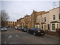
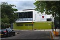
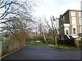
1
Thorpedale Road
Thorpedale road connects Evershot Road and Hornsey Road. It also runs parallel to Corbyn Street and is home to Wray Crescent Open Space.
Image: © Finlay Cox
Taken: 28 Dec 2011
0.01 miles
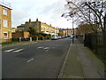
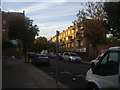
2
Wray Crescent Open Space
At the end of Turle Road
Image: © David Howard
Taken: 2 Jan 2021
0.06 miles
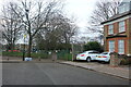
5
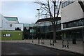
The Artist & Media School, Finsbury Park
Image: © David Howard
Taken: 2 Jan 2021
0.10 miles
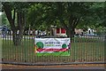
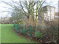
7
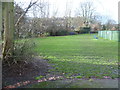
Wray Crescent Open Space
This is Wray Crescent Open Space. The photograph is taken from the end of Tollington Place. The houses seen here across the park are in Wray Crescent.
Image: © Marathon
Taken: 28 Jan 2015
0.12 miles
8
The end of Tollington Place
Wray Crescent Open Space is to the left and ahead on the other side of the fence. Tollington Place to the right leads to Tollington Park.
Image: © Marathon
Taken: 28 Jan 2015
0.12 miles
9
Wray Crescent Open Space
This is Wray Crescent Open Space. To the right of the railings is Tollington Place, which leads to Tollington Park - see http://www.geograph.org.uk/photo/4328571
Image: © Marathon
Taken: 28 Jan 2015
0.12 miles