IMAGES TAKEN NEAR TO
Atterbury Road, LONDON, N4 1SG
Introduction
This page details the photographs taken nearby to Atterbury Road, N4 1SG by members of the Geograph project.
The Geograph project started in 2005 with the aim of publishing, organising and preserving representative images for every square kilometre of Great Britain, Ireland and the Isle of Man.

There are currently over 7.5m images from over14,400 individuals and you can help contribute to the project by visiting https://www.geograph.org.uk
Image Map
Images are licensed for reuse under creativecommons.org/licenses/by-sa/2.0
Notes
- Clicking on the map will re-center to the selected point.
- The higher the marker number, the further away the image location is from the centre of the postcode.
Image Listing (254 Images Found)
Images are licensed for reuse under creativecommons.org/licenses/by-sa/2.0
Image
Details
Distance
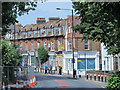
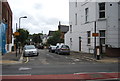
2
Wightman Road, N4 (2)
The east side, between Umfreville Road and Atterbury Road.
Image: © Mike Quinn
Taken: 18 Jun 2015
0.03 miles
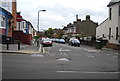
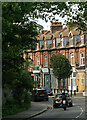
3
Wightman Road, N4
Around Atterbury Road.
Image: © Mike Quinn
Taken: 18 Jun 2015
0.03 miles
5
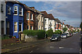
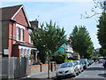
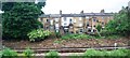
Umfreville Road, Harringay
A burst of sunshine following a rain shower catches the houses on the northern side of Umfreville Road. This is one of a set of twenty parallel streets, running between Green Lanes and Wightman Road, known collectively as the 'Harringay Ladder' because on a map or from the air that is what they resemble.
Image: © Stephen McKay
Taken: 27 Aug 2011
0.04 miles
6
Umfreville Road, N4
Umfraville is the name of an English baronial family, derived from Amfreville in Normandy https://en.wikipedia.org/wiki/Umfraville .
Image: © Mike Quinn
Taken: 18 Jun 2015
0.04 miles
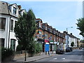
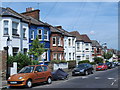
8
Harringay : Wightman Road
An erstwhile parade of shops long since closed.
Image: © Jim Osley
Taken: 3 Jun 2021
0.04 miles
10
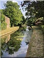
The New River
Opened 1613 to supply drinking water to London from the river Lea.
Wikipedia entry: https://en.wikipedia.org/wiki/New_River_(London)
Image: © David Robinson
Taken: 16 Jun 2022
0.05 miles