IMAGES TAKEN NEAR TO
The Drive, LONDON, N3 1AE
Introduction
This page details the photographs taken nearby to The Drive, N3 1AE by members of the Geograph project.
The Geograph project started in 2005 with the aim of publishing, organising and preserving representative images for every square kilometre of Great Britain, Ireland and the Isle of Man.

There are currently over 7.5m images from over14,400 individuals and you can help contribute to the project by visiting https://www.geograph.org.uk
Image Map
Images are licensed for reuse under creativecommons.org/licenses/by-sa/2.0
Notes
- Clicking on the map will re-center to the selected point.
- The higher the marker number, the further away the image location is from the centre of the postcode.
Image Listing (87 Images Found)
Images are licensed for reuse under creativecommons.org/licenses/by-sa/2.0
Image
Details
Distance
1
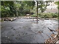
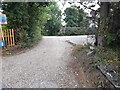
Finchley Way Open Space
The area has been upgraded, this appears to be a new public area under construction as I don't remember a path to here before.
Image: © David Howard
Taken: 1 Sep 2022
0.01 miles

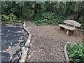


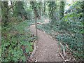


9
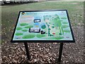
Sign at the entrance of Finchley Way Open Space
From what I remember the new woods and gardens reached from a path at the edge is new, and certainly still under construction as you will see in the series taken.
Image: © David Howard
Taken: 1 Sep 2022
0.04 miles