IMAGES TAKEN NEAR TO
Totnes Walk, LONDON, N2 0AD
Introduction
This page details the photographs taken nearby to Totnes Walk, N2 0AD by members of the Geograph project.
The Geograph project started in 2005 with the aim of publishing, organising and preserving representative images for every square kilometre of Great Britain, Ireland and the Isle of Man.

There are currently over 7.5m images from over14,400 individuals and you can help contribute to the project by visiting https://www.geograph.org.uk
Image Map
Images are licensed for reuse under creativecommons.org/licenses/by-sa/2.0
Notes
- Clicking on the map will re-center to the selected point.
- The higher the marker number, the further away the image location is from the centre of the postcode.
Image Listing (242 Images Found)
Images are licensed for reuse under creativecommons.org/licenses/by-sa/2.0
Image
Details
Distance
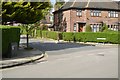
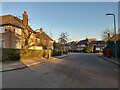
4
Vivian Way, Hampstead Garden Suburb
Most of the art deco houses had flat rooves till the 90s, now they all have had new ones added often with loft rooms as well.
Image: © David Howard
Taken: 9 May 2014
0.05 miles
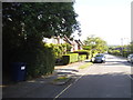
5
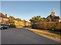
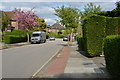
Brim Hill at the junction of Widecombe Way
Image: © David Howard
Taken: 7 Feb 2023
0.06 miles
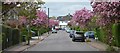
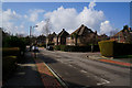
8
Vivian Way
Looking along Vivian Way at its western end towards Widecombe Way.
Image: © Martin Addison
Taken: 20 May 2007
0.07 miles
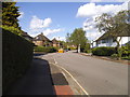
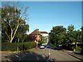
10
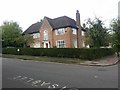
House on Widecombe Way, Hampstead Garden Suburb
Image: © David Howard
Taken: 27 Apr 2020
0.07 miles