IMAGES TAKEN NEAR TO
Whitehead Close, LONDON, N18 1UZ
Introduction
This page details the photographs taken nearby to Whitehead Close, N18 1UZ by members of the Geograph project.
The Geograph project started in 2005 with the aim of publishing, organising and preserving representative images for every square kilometre of Great Britain, Ireland and the Isle of Man.

There are currently over 7.5m images from over14,400 individuals and you can help contribute to the project by visiting https://www.geograph.org.uk
Image Map
Images are licensed for reuse under creativecommons.org/licenses/by-sa/2.0
Notes
- Clicking on the map will re-center to the selected point.
- The higher the marker number, the further away the image location is from the centre of the postcode.
Image Listing (56 Images Found)
Images are licensed for reuse under creativecommons.org/licenses/by-sa/2.0
Image
Details
Distance
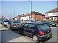
1
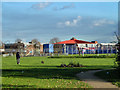
Weir Hall Park and Wilbury Primary School
The striking roof of one of the school blocks is seen across this fairly small green area.
Image: © Robin Webster
Taken: 11 Nov 2012
0.10 miles
2
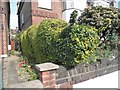
Caterpillar hedge on Great Cambridge Road, Edmonton
Image: © David Howard
Taken: 26 May 2018
0.13 miles
3
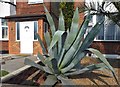
Giant cactus on Great Cambridge Road, Edmonton
Image: © David Howard
Taken: 26 May 2018
0.14 miles
4
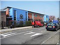
Wilbury Primary School, Weir Hall Road
Contrasting nicely with the post office van. There are two primary schools on Weir Hall Road - this one is in Enfield http://www.wilbury.enfield.sch.uk/ and the one opposite the Weymarks is in Haringey.
Image: © Christine Johnstone
Taken: 23 Mar 2012
0.14 miles
5
Wilbury Way, N18
A block of houses on the north side of the road.
Image: © Christine Johnstone
Taken: 23 Mar 2012
0.15 miles
6
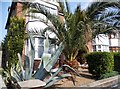
Tropical Edmonton
People assume you can't grow greenhouse plants outdoors in London, but they may need covering in winter to keep them alive.
Image: © David Howard
Taken: 26 May 2018
0.16 miles
7
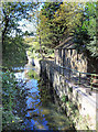
Pymme's Brook Trail by the Brook
The Pymme's Brook Trail follows the course of the brook from its source near Cockfosters down to the River Lea. Due to the nature of urban watercourses it isn't always possible to be this near to the stream, but the route through this square manages to stay closer than usual.
Image: © Des Blenkinsopp
Taken: 9 Oct 2018
0.17 miles
8

Lansbury Avenue
From its junction with Weir Hall Road.
Image: © Christine Johnstone
Taken: 23 Mar 2012
0.18 miles
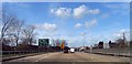
10
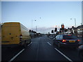
The Great Cambridge Road, Upper Edmonton
At the junction of Pasteur Gardens
Image: © David Howard
Taken: 7 Jan 2014
0.18 miles