1
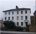
Valide Sultan Mosque
This Turkish mosque (behind the wall) and cultural centre was built in 1992 and occupies a triangular site at 1a Clissold Road that was formerly the site of stables belonging a large house that is now gone. Clissold Road itself was constructed in the 1880s to house prosperous families, and although the end house here looks original it is in fact a replica designed to match its neighbours.
Image: © Natasha Ceridwen de Chroustchoff
Taken: 27 Jul 2009
0.03 miles
2
The former Albion Public House, Stoke Newington
Grade II listed house on the junction of Clissold Road and Church Walk (on the right).
See http://www.britishlistedbuildings.co.uk/en-423699-the-albion-public-house-greater-london-a for more details about the listed house.
Image: © David Anstiss
Taken: 3 Feb 2013
0.03 miles
3
UK Turkish Islamic Centre Trust, Stoke Newington
Small cultural centre on Clissold Road.
Image: © David Anstiss
Taken: 3 Feb 2013
0.04 miles
4
Clissold Rd
Image: © N Chadwick
Taken: 10 Feb 2017
0.05 miles
5
Old factory in Church Walk
Church Walk no longer goes through to Church Street and, heading north, it ends here in a cul-de-sac beside what appears to be a derelict factory. Beyond it a footpath turns right into Albion Road.
Image: © Natasha Ceridwen de Chroustchoff
Taken: 27 Jul 2009
0.05 miles
6
No.147 and No.149, Albion Road, Stoke Newington
2 Grade II listed houses on Albion Road.
See http://www.britishlistedbuildings.co.uk/en-426482-147-and-149-albion-road-n16-greater-lond for more details about the buildings.
Image: © David Anstiss
Taken: 3 Feb 2013
0.05 miles
7
Albion Rd, B104
Image: © N Chadwick
Taken: 10 Feb 2017
0.05 miles
8
Stoke Newington Tantarian Spiritual Baptist Church
Image: © N Chadwick
Taken: 10 Feb 2017
0.06 miles
9
No154 and No156 Albion Road, Stoke Newington
Two Grade II listed buildings on Albion Road. No 154 faces Albion Grove.
See http://www.britishlistedbuildings.co.uk/en-201704-154-and-156-albion-road-n16-greater-lond for more details about the buildings.
Image: © David Anstiss
Taken: 3 Feb 2013
0.06 miles
10
No154 and No156 Albion Road, Stoke Newington
Two Grade II listed buildings on Albion Road. No 154 faces Albion Grove (in front).
See http://www.britishlistedbuildings.co.uk/en-201704-154-and-156-albion-road-n16-greater-lond for more details about the buildings.
Image: © David Anstiss
Taken: 3 Feb 2013
0.06 miles


