1
Hewling Estate, Stoke Newington
Rain clouds gather over these blocks of flats on the north side of Matthias Road. The two blocks facing each other across the green form the Hewling estate and were constructed in the late 1930s to replace an area of poor quality housing. Hewling House is to the left, Matthias House to the right; there were originally three blocks but the third was destroyed by a Second World War bomb. The tall block in the background is Chaucer House, part of the Milton Gardens Estate. More details of the history of this area are available here: http://www.locallocalhistory.co.uk/municipal-housing/howard/index.htm
Image: © Stephen McKay
Taken: 15 May 2009
0.02 miles
2
Howard Road, London N16 - St Matthias church
Saint Matthias church in the distance, looking down Howard Road from Albion Road.
Image: © Chris Sitton
Taken: 17 Jun 2007
0.03 miles
3
Stoke Newington: Matthias Road
Looking west. The north side is occupied by the large premises of Travis Perkins, builder's merchants.
Image: © Dr Neil Clifton
Taken: 7 Oct 2010
0.05 miles
4
Matthias Road, Stoke Newington
On the southern edge of Stoke Newington, Matthias Road runs east of Newington Green and forms the boundary between the boroughs of Islington (to the right) and Hackney (to the left). The block on the right is part of the Mayville Estate.
Image: © Stephen McKay
Taken: 15 May 2009
0.05 miles
5
Paths and Grass, Matthias Road
This small rectangular green and diagonal paths and central tree is surrounded on 2 sides (on the left) by shops. On the right is Cowper Road.
In the background is
Image
Image: © David Anstiss
Taken: 3 Feb 2013
0.05 miles
6
Mayville Estate
Seen here from Matthias Road, this block forms part of the Mayville Estate, originally developed by the London County Council between 1947 and 1952.
Image: © Stephen McKay
Taken: 15 May 2009
0.06 miles
7
Stoke Newington: The 'Army and Navy'
Image: © Dr Neil Clifton
Taken: 7 Oct 2010
0.06 miles
8
St Matthias, Stoke Newington - Wall painting
Image: © John Salmon
Taken: 29 Oct 2014
0.07 miles
9
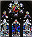
St Matthias, Stoke Newington - Stained glass window
Image: © John Salmon
Taken: 29 Oct 2014
0.07 miles
10
St Matthias, Stoke Newington - Altar
Image: © John Salmon
Taken: 29 Oct 2014
0.07 miles


