1
Howard Road, London N16 - St Matthias church
Saint Matthias church in the distance, looking down Howard Road from Albion Road.
Image: © Chris Sitton
Taken: 17 Jun 2007
0.06 miles
2
Hewling Estate, Stoke Newington
Rain clouds gather over these blocks of flats on the north side of Matthias Road. The two blocks facing each other across the green form the Hewling estate and were constructed in the late 1930s to replace an area of poor quality housing. Hewling House is to the left, Matthias House to the right; there were originally three blocks but the third was destroyed by a Second World War bomb. The tall block in the background is Chaucer House, part of the Milton Gardens Estate. More details of the history of this area are available here: http://www.locallocalhistory.co.uk/municipal-housing/howard/index.htm
Image: © Stephen McKay
Taken: 15 May 2009
0.07 miles
3
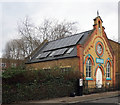
Wordsworth Road Baptist Chapel, Stoke Newington
Built in 1894. Locally listed. Description at this http://hackneybuildings.org/items/show/19402
Image: © Jim Osley
Taken: 11 Jan 2017
0.07 miles
4
Electricity sub-station, Stoke Newington
Built in 1929. Locally listed. Description at this http://hackneybuildings.org/items/show/19619.
Image: © Jim Osley
Taken: 11 Jan 2017
0.09 miles
5
Butterfield Green, Stoke Newington (2)
A little park in the middle of a densely populated area. This is a rockery area.
Image: © Danny P Robinson
Taken: 8 Apr 2007
0.09 miles
6
St Matthias Church Hall, Stoke Newington
On Wordsworth Road.
Used as a community centre.
Image: © David Anstiss
Taken: 3 Feb 2013
0.09 miles
7
Butterfield Green, Stoke Newington (1)
A little park in the middle of a densely populated area. Picture taken from the Bandstand.
Image: © Danny P Robinson
Taken: 8 Apr 2007
0.09 miles
8
Matthias Road, Stoke Newington
On the southern edge of Stoke Newington, Matthias Road runs east of Newington Green and forms the boundary between the boroughs of Islington (to the right) and Hackney (to the left). The block on the right is part of the Mayville Estate.
Image: © Stephen McKay
Taken: 15 May 2009
0.10 miles
9
Church Walk at Howard Street
Church Walk, heading north and running parallel to Albion Road.
Image: © Natasha Ceridwen de Chroustchoff
Taken: 27 Jul 2009
0.11 miles
10
Stoke Newington: Matthias Road
Looking west. The north side is occupied by the large premises of Travis Perkins, builder's merchants.
Image: © Dr Neil Clifton
Taken: 7 Oct 2010
0.11 miles


