1
St Paul's Church, Stoke Newington Road - Wall painting
Image: © John Salmon
Taken: 12 May 2011
0.03 miles
2
Hackney southern fringe: Princess May Primary School
Typical LCC school building, of which there are quite a few still in use: They have stood the test of time well. Playground full of happy-looking active kids.
Image: © Dr Neil Clifton
Taken: 1 May 2012
0.03 miles
3
Stoke Newington: Barrett Grove
Image: © Dr Neil Clifton
Taken: 7 Oct 2010
0.03 miles
4
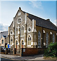
Church of God World Fellowship, Barrett's Grove, Stoke Newington
Former Welsh Congregational Chapel of c. 1884.
Image: © Jim Osley
Taken: 7 Sep 2017
0.04 miles
5
Princess May Road, N16
A typical Stoke Newington side street.
Image: © Danny P Robinson
Taken: 1 Apr 2007
0.04 miles
6
Stoke Newington: Pellerin Road
Looking east from Boleyn Road. Years ago, there were thousands of streets like this, with the well-built London style terrace houses, surprisingly spacious inside. There are still plenty of these streets around, BUT - there are a lot less than there were. Surely it is now time to protect those that we still have, and concentrate demolition on the rubbish that was built in the 1960s.
Doubtless, the residents of Pellerin Road provide enough custom to keep Micky's Chippy in business.
Image: © Dr Neil Clifton
Taken: 7 Oct 2010
0.04 miles
7
Hackney (southern fringes): Church of God (World Fellowship),Barrett's Grove
The datestone reads '1985', but I interpret this as being the date of refurbishment by the present owners. There is no church marked here on the OS map, but it looks Victorian.
Image: © Dr Neil Clifton
Taken: 1 May 2012
0.05 miles
8
Princess May Road, Shacklewell
Image: © Chris Whippet
Taken: 12 Jul 2015
0.06 miles
9
Hackney (southern fringes): The 'Marquis of Lansdowne'
This pub is still open, but my extensive experience in such matters suggests that this is in its last throes.
Image: © Dr Neil Clifton
Taken: 1 May 2012
0.07 miles
10
Street sign, Belgrade Road N16
Image: © Robin Sones
Taken: 26 May 2012
0.07 miles


