IMAGES TAKEN NEAR TO
Belmont Road, LONDON, N15 3LS
Introduction
This page details the photographs taken nearby to Belmont Road, N15 3LS by members of the Geograph project.
The Geograph project started in 2005 with the aim of publishing, organising and preserving representative images for every square kilometre of Great Britain, Ireland and the Isle of Man.

There are currently over 7.5m images from over14,400 individuals and you can help contribute to the project by visiting https://www.geograph.org.uk
Image Map
Images are licensed for reuse under creativecommons.org/licenses/by-sa/2.0
Notes
- Clicking on the map will re-center to the selected point.
- The higher the marker number, the further away the image location is from the centre of the postcode.
Image Listing (71 Images Found)
Images are licensed for reuse under creativecommons.org/licenses/by-sa/2.0
Image
Details
Distance
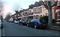
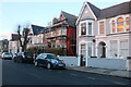
1

Belmont Road at the junction of Langham Road
Image: © David Howard
Taken: 25 Jun 2014
0.06 miles
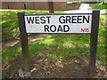
3
West Green Road N15
Looking towards Harringay on the A504 which ultimately leads to West Hendon Broadway .
Image: © David Howard
Taken: 9 Mar 2010
0.08 miles
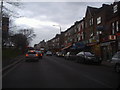
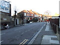
5
West Green Road N15
At the junction with Belmont Road
Image: © Robin Sones
Taken: 29 Aug 2013
0.09 miles
6
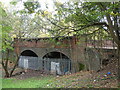
Belmont Road Overbridge (Sheltering The Homeless?)
The other side of the two old railway brick arches is boarded up and is the boundary to the Park View School playing field. On this side the metal fencing has been broken at one point to allow access. Sheets have been tied to the fence for privacy as inside the arches there is bedding and seating, other evidence of habitation such as a fire and even a framed picture. Clearly someone is or has been living there. The simple elegance of the bridge is marred by the utilitarian fencing which has in any case failed to keep people out.
Image: © John Kingdon
Taken: 9 Nov 2023
0.09 miles
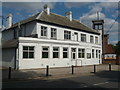
9
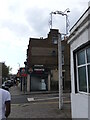
The Silver Lady (as was) pub sign post
The Silver Lady pub was quite a dive and closed in the mid 1990's. with little regret. The pub sign post remains with lights pointing to the empty space where once the sign hung. It is as redundant now as the indecipherable early twentieth century advertising sign on the wall of the building opposite on Vincent Road.
Image: © John Kingdon
Taken: 15 Apr 2023
0.10 miles
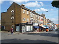
10
Building, West Green Road N15
At the junction with Vincent Road
Image: © Robin Sones
Taken: 29 Aug 2013
0.10 miles