Belmont Road Overbridge (Sheltering The Homeless?)
Introduction
The photograph on this page of Belmont Road Overbridge (Sheltering The Homeless?) by John Kingdon as part of the Geograph project.
The Geograph project started in 2005 with the aim of publishing, organising and preserving representative images for every square kilometre of Great Britain, Ireland and the Isle of Man.

There are currently over 7.5m images from over 14,400 individuals and you can help contribute to the project by visiting https://www.geograph.org.uk
Belmont Road Overbridge (Sheltering The Homeless?)
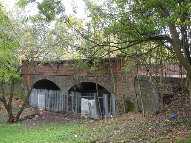
Image: © John Kingdon Taken: 9 Nov 2023
The other side of the two old railway brick arches is boarded up and is the boundary to the Park View School playing field. On this side the metal fencing has been broken at one point to allow access. Sheets have been tied to the fence for privacy as inside the arches there is bedding and seating, other evidence of habitation such as a fire and even a framed picture. Clearly someone is or has been living there. The simple elegance of the bridge is marred by the utilitarian fencing which has in any case failed to keep people out.
Images are licensed for reuse under creativecommons.org/licenses/by-sa/2.0
Image Location
Latitude
51.588675
Longitude
-0.093261