IMAGES TAKEN NEAR TO
Nether Street, LONDON, N12 7NP
Introduction
This page details the photographs taken nearby to Nether Street, N12 7NP by members of the Geograph project.
The Geograph project started in 2005 with the aim of publishing, organising and preserving representative images for every square kilometre of Great Britain, Ireland and the Isle of Man.

There are currently over 7.5m images from over14,400 individuals and you can help contribute to the project by visiting https://www.geograph.org.uk
Image Map
Images are licensed for reuse under creativecommons.org/licenses/by-sa/2.0
Notes
- Clicking on the map will re-center to the selected point.
- The higher the marker number, the further away the image location is from the centre of the postcode.
Image Listing (119 Images Found)
Images are licensed for reuse under creativecommons.org/licenses/by-sa/2.0
Image
Details
Distance
1
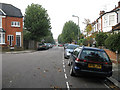
Netherfield Road N12
Looking down Netherfield road, from the junction with Grange Avenue, towards the junction with Gainsborough Road and Nether Street.
Image: © Martin Addison
Taken: 16 Oct 2006
0.03 miles
2
Information Board, St Alban's Church, Nether Street N12
Image: © Robin Sones
Taken: 24 Sep 2010
0.06 miles
3
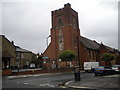
St Alban's RC Church, Birkbeck Road N12
At the junction with Nether Street
Image: © Robin Sones
Taken: 24 Sep 2010
0.06 miles
4
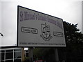
Sign, St Michael's Catholic Grammar School, Nether Street N12
Image: © Robin Sones
Taken: 24 Sep 2010
0.06 miles
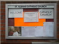
5
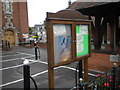
Notice board, St Alban's Church, Nether Street N12
Image: © Robin Sones
Taken: 24 Sep 2010
0.07 miles
6
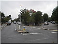
Gainsborough Road N12
At the junction with Netherfield Road - looking across Nether Street
Image: © Robin Sones
Taken: 24 Sep 2010
0.08 miles
7
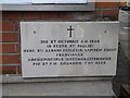
Foundation stone, St Alban's Church. Nether Street N12
Image: © Robin Sones
Taken: 24 Sep 2010
0.08 miles
8
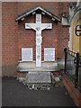
Parish war memorial, St Alban's Church, Nether Street N12
Image: © Robin Sones
Taken: 24 Sep 2010
0.09 miles
9
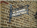
Sign, St Alban's Presbytery, Nether Street N12
Image: © Robin Sones
Taken: 24 Sep 2010
0.09 miles
10
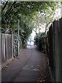
Church Path N12
Looking along Church Path from the Netherfield Road end towards its junction with Percy Road where the alleyway opens out into a cul-de-sac with houses before becoming an alley once more as it continues to Lodge Lane. The lady pedestrian in the distance is on the section leading to Lodge Lane. Church Path continues north from Lodge lane until it connects with the High Road in the vicinity of The Swan and Pyramids public house.
Image: © Martin Addison
Taken: 16 Oct 2006
0.10 miles