IMAGES TAKEN NEAR TO
Shortgate, LONDON, N12 7JP
Introduction
This page details the photographs taken nearby to Shortgate, N12 7JP by members of the Geograph project.
The Geograph project started in 2005 with the aim of publishing, organising and preserving representative images for every square kilometre of Great Britain, Ireland and the Isle of Man.

There are currently over 7.5m images from over14,400 individuals and you can help contribute to the project by visiting https://www.geograph.org.uk
Image Map
Images are licensed for reuse under creativecommons.org/licenses/by-sa/2.0
Notes
- Clicking on the map will re-center to the selected point.
- The higher the marker number, the further away the image location is from the centre of the postcode.
Image Listing (28 Images Found)
Images are licensed for reuse under creativecommons.org/licenses/by-sa/2.0
Image
Details
Distance
1
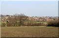
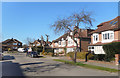
View Towards Whetstone
Taken from the footpath that passes through Frith Manor Livery Stable and behind the London Equestrian Centre. The path is quite difficult to follow as it is poorly signposted and possibly due to changing fencing requirements within the livery stables. However, the people on site were very friendly and helpful in giuding us back to the path when we were unable to find it. In the foreground the field has been ploughed up by the horses hooves making stout hiking boots essential in the sticky wet mud. Beyond are the houses on Chanctonbury Way and Michleham Down. The tall white office blocks on the horizon are Northway House near the centre and Barnet House to the right.
Image: © Martin Addison
Taken: 11 Mar 2012
0.08 miles
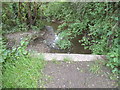
2
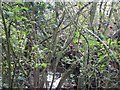
Folly Brook, late October
A small and somewhat inaccessible trickle of water...
Image: © Keith Salvesen
Taken: 23 Oct 2007
0.10 miles
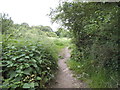
3
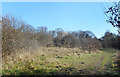
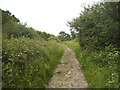
Footpath near Woodside Park
A permissive path on the edge of a large area of old fields and woodland which has somehow avoided the developers.
Image: © Des Blenkinsopp
Taken: 26 Feb 2019
0.12 miles
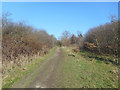
5
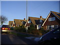
Path from Mill Hill to Woodside Park
This branch meets the road at Southover
Image: © David Howard
Taken: 11 Jun 2014
0.16 miles
6
An Unmarked Path
Not shown on the map, but there is a good path beside a small stream from Woodside Park towards Darlands Lake.
Image: © Des Blenkinsopp
Taken: 26 Feb 2019
0.16 miles
7
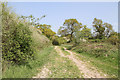
Footpath to Laurel Farm
Climbing out of the valley of Folly Brook. This path connects Burtonhole Lane with The Croft.
Image: © Martin Addison
Taken: 19 Apr 2011
0.17 miles
8
Stream going under the path to Woodside Park
Image: © David Howard
Taken: 11 Jun 2014
0.17 miles
10
Path from Mill Hill to Woodside Park
The area east of The Ridgeway is the end of suburban London and the beginning of open farmland with a few roads going through it until Barnet. It is crossed by many public footpaths joining all the roads with each other.
Image: © David Howard
Taken: 11 Jun 2014
0.17 miles