IMAGES TAKEN NEAR TO
Prevost Road, LONDON, N11 1EN
Introduction
This page details the photographs taken nearby to Prevost Road, N11 1EN by members of the Geograph project.
The Geograph project started in 2005 with the aim of publishing, organising and preserving representative images for every square kilometre of Great Britain, Ireland and the Isle of Man.

There are currently over 7.5m images from over14,400 individuals and you can help contribute to the project by visiting https://www.geograph.org.uk
Image Map
Images are licensed for reuse under creativecommons.org/licenses/by-sa/2.0
Notes
- Clicking on the map will re-center to the selected point.
- The higher the marker number, the further away the image location is from the centre of the postcode.
Image Listing (47 Images Found)
Images are licensed for reuse under creativecommons.org/licenses/by-sa/2.0
Image
Details
Distance
1
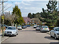
Prevost Road, N11
Heading down to meet Brunswick Park Road.
Image: © Robin Webster
Taken: 6 Apr 2013
0.03 miles
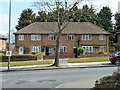
2
Postal drop box on Prevost Road, N11
This is not for public use, but a secure place for temporary storage of mail during delivery rounds.
Image: © Robin Webster
Taken: 6 Apr 2013
0.03 miles
3
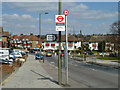
Osidge library bus stop
It is served by route 382 towards Southgate. The library is across the zebra crossing beside the health centre.
Image: © Robin Webster
Taken: 6 Apr 2013
0.04 miles
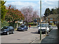
4
Houses on Brunswick Park Road, N11
The sign on the left seems to have moved round square to its intended position, it warns buses of low trees.
Image: © Robin Webster
Taken: 6 Apr 2013
0.06 miles
8
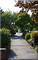
Pavement Alongside Russell Lane
Shrubs and trees screen the pedestrians and the houses from the busy traffic along this road which passes on the right.
Image: © Martin Addison
Taken: 10 May 2009
0.09 miles
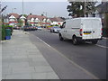
9
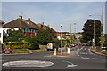
Osidge Lane
The B1453, seen from the junction with Brunswick Park Road. The road drops down into the valley of Pymme's Brook before climbing to connect with the A111, Chase Side, on the horizon.
Image: © Martin Addison
Taken: 10 May 2009
0.09 miles
10
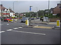
Russell Lane at the junction of Osidge Lane
Image: © David Howard
Taken: 25 Sep 2013
0.10 miles