
IMAGES TAKEN NEAR TO
WISHAW, ML2 0RT
Introduction
This page details the photographs taken nearby to ML2 0RT by members of the Geograph project.
The Geograph project started in 2005 with the aim of publishing, organising and preserving representative images for every square kilometre of Great Britain, Ireland and the Isle of Man.

There are currently over 7.5m images from over14,400 individuals and you can help contribute to the project by visiting https://www.geograph.org.uk
Image Map
Images are licensed for reuse under creativecommons.org/licenses/by-sa/2.0
Notes
- Clicking on the map will re-center to the selected point.
- The higher the marker number, the further away the image location is from the centre of the postcode.
Image Listing (16 Images Found)
Images are licensed for reuse under creativecommons.org/licenses/by-sa/2.0
Image
Details
Distance
1
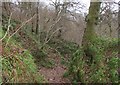
Path in Garrion Gill Nature Reserve
Muted woodland colours on a grey and mild January afternoon.
Image: © Alan O'Dowd
Taken: 4 Jan 2020
0.12 miles
2
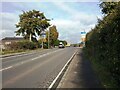
Horsley Brae entering Overtown
Traffic having climbed up from the Clyde valley
Image: © Jim Smillie
Taken: 12 Oct 2023
0.14 miles
3
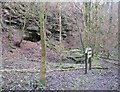
Outcrops in Garrion Gill
The flat area in the foreground is marked on 19th Century Ordnance Survey maps as containing buildings which were part of Shawhead Colliery. The specific location is marked as Tapponhill Mine.
Image: © Alan O'Dowd
Taken: 4 Jan 2020
0.14 miles
4
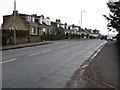
Main Street
The A71 running through Overtown.
Image: © Richard Webb
Taken: 11 Feb 2011
0.14 miles
5
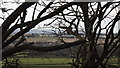
Jacob's Ladder
Looking from Bluebell Way in Law village towards Overtown and Clyde Valley.
Image: © Digitalbabe
Taken: 14 Feb 2013
0.16 miles
6
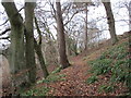
Old path from Garrion Gill to Horsley Brae
Old maps show an orchard called Blair's Orchard on the right (the name is still marked on the map) but the path now comes out at a gate to a modern housing development off Horsley Brae.
Image: © Alan O'Dowd
Taken: 4 Jan 2020
0.17 miles
7
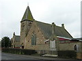
Overtown Parish Church and War Memorial
Image: © Iain Thompson
Taken: 11 Mar 2006
0.18 miles
8
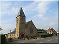
Overtown Parish Church
Viewed from the south-east.
Image: © Peter Wood
Taken: 15 Sep 2016
0.18 miles
9
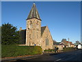
Overtown, South Lanarkshire
The parish church.
Image: © James Denham
Taken: 4 Nov 2013
0.19 miles
10
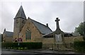
Overtown Parish Church And War Memorial
Overtown Parish Church on a wet grey morning.
Overtown Parish Church was given full status on 17th July 1876 under the guidance of the minister Rev George Burnett. Prior to this Overtown was a Chapel of Ease and worshipped in the village. The church was heated by two coal fires – one in the north-west corner (now a cupboard, behind the choir) and the other in the South-east corner (behind the entrance vestibule), and lit by paraffin lamps. In 1885 there were 205 members on the Communion Roll.
Image: © Rude Health
Taken: 27 Aug 2015
0.20 miles