IMAGES TAKEN NEAR TO
Parbrook Road, ROCHESTER, ME3 8QG
Introduction
This page details the photographs taken nearby to Parbrook Road, ME3 8QG by members of the Geograph project.
The Geograph project started in 2005 with the aim of publishing, organising and preserving representative images for every square kilometre of Great Britain, Ireland and the Isle of Man.

There are currently over 7.5m images from over14,400 individuals and you can help contribute to the project by visiting https://www.geograph.org.uk
Image Map
Images are licensed for reuse under creativecommons.org/licenses/by-sa/2.0
Notes
- Clicking on the map will re-center to the selected point.
- The higher the marker number, the further away the image location is from the centre of the postcode.
Image Listing (31 Images Found)
Images are licensed for reuse under creativecommons.org/licenses/by-sa/2.0
Image
Details
Distance
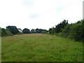
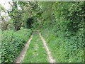
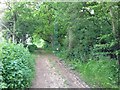
2
Parbrook Road from Parbrook House
This road leads to a junction and then left to Fenn Street. It is also used by the Saxon Shore Way (long distance path) between High Halstow and Hoo.
Image: © David Anstiss
Taken: 1 Nov 2009
0.05 miles
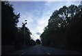
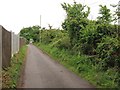
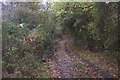
3
Roper's Green Lane, near High Halstow
Image: © Chris Whippet
Taken: 20 May 2016
0.06 miles
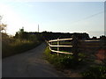
4
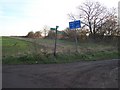
Byway junction on Saxon Shore Way
Parbrook Road from Ratcliffe Highway meets the long distance path, which travels left to Parbrook House. Or travels right on Ropers Green Lane (a named byway) to Ropers Farm near Sharnel Street.
Image: © David Anstiss
Taken: 9 Jan 2009
0.06 miles
7
Roper's Green Lane, near High Halstow
Image: © Chris Whippet
Taken: 20 May 2016
0.09 miles
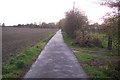
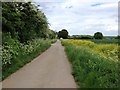
8
Muddy Section of Roper's Green Lane
This byway leads from Roper's Lane, past Roper's Farm, now it gets closer to Parbrook Road, near Fenn Street. The byway is near many horse paddocks hence muddy section. The byway is also used by the Saxon Shore Way (long distance Path) heading from Hoo to High Halstow.
Image: © David Anstiss
Taken: 1 Nov 2009
0.09 miles