IMAGES TAKEN NEAR TO
Hagelstowe Avenue, ROCHESTER, ME3 8FU
Introduction
This page details the photographs taken nearby to Hagelstowe Avenue, ME3 8FU by members of the Geograph project.
The Geograph project started in 2005 with the aim of publishing, organising and preserving representative images for every square kilometre of Great Britain, Ireland and the Isle of Man.

There are currently over 7.5m images from over14,400 individuals and you can help contribute to the project by visiting https://www.geograph.org.uk
Image Map
Images are licensed for reuse under creativecommons.org/licenses/by-sa/2.0
Notes
- Clicking on the map will re-center to the selected point.
- The higher the marker number, the further away the image location is from the centre of the postcode.
Image Listing (28 Images Found)
Images are licensed for reuse under creativecommons.org/licenses/by-sa/2.0
Image
Details
Distance
2
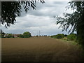
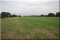
Footpath near High Halstow
This footpath leads away from Britannia Road and turns right just ahead to reach Walnut Tree Farm and Clint Street. The houses on the left are in Longfield Avenue at High Halstow.
Image: © Marathon
Taken: 13 Aug 2013
0.10 miles
4
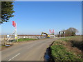
Site of new housing, High Halstow
The site of a new housing development alongside Britannia Road in the village of High Halstow. This image was taken in early 2019, when work was still at an early stage.
Image: © Malc McDonald
Taken: 23 Feb 2019
0.12 miles
5
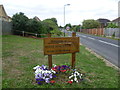
Village sign at High Halstow
The heron symbolises the nearby Northward Hill RSPB Reserve. This is the approach from Fenn Street along Britannia Road. Another sign with the heron in the centre of the village can be seen at http://www.geograph.org.uk/photo/3602049
Image: © Marathon
Taken: 13 Aug 2013
0.13 miles
8
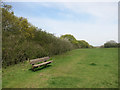
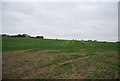
Not the Saxon Shore Way
Parallel to it but just a few metres away on the other side of the hedge. This is a patch of grassland on the edge of High Halstow that looks like it's used by local people for dog walking etc.
Image: © Des Blenkinsopp
Taken: 21 Apr 2016
0.16 miles