
IMAGES TAKEN NEAR TO
Noke Street, ROCHESTER, ME3 8BJ
Introduction
This page details the photographs taken nearby to Noke Street, ME3 8BJ by members of the Geograph project.
The Geograph project started in 2005 with the aim of publishing, organising and preserving representative images for every square kilometre of Great Britain, Ireland and the Isle of Man.

There are currently over 7.5m images from over14,400 individuals and you can help contribute to the project by visiting https://www.geograph.org.uk
Image Map
Images are licensed for reuse under creativecommons.org/licenses/by-sa/2.0
Notes
- Clicking on the map will re-center to the selected point.
- The higher the marker number, the further away the image location is from the centre of the postcode.
Image Listing (7 Images Found)
Images are licensed for reuse under creativecommons.org/licenses/by-sa/2.0
Image
Details
Distance
1
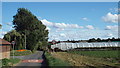
Bunters Hill Road, near Wainscott
Bunters Hill Road passes through farmland in Kent. This road forms part of National Cycle Network route 1.
Image: © Malc McDonald
Taken: 7 Sep 2013
0.09 miles
2
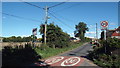
Higham Road, Wainscott
Higham Road on the edge of the village of Wainscott in Kent. The speed limit changes here from 30mph to 20mph. This lane forms part of National Cycle network route 1.
Image: © Malc McDonald
Taken: 7 Sep 2013
0.17 miles
3
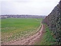
Footpath from Haven Street to Wainscott
Picture taken from Haven Street. The field was at one time an orchard.
Image: © Richard Dorrell
Taken: 8 Mar 2008
0.17 miles
4
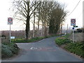
Higham Road, near Chattenden
This road is on the route of National Cycle Network routes 1 and 179. Route 179, named "The Heron Trail", was previously designated as regional cycle route 18.
Image: © Malc McDonald
Taken: 23 Feb 2019
0.18 miles
5
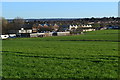
View across field to Royal School of Military Engineering
Image: © David Martin
Taken: 25 Mar 2017
0.20 miles
6
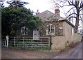
Mount Lodge
This is a lodge cottage to a house called The Mount.
Image: © Richard Dorrell
Taken: 28 Dec 2007
0.22 miles
7
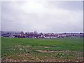
REME Construction Engineers School
Viewed from Haven Street. The school occupies a large site which includes classrooms, warehouses, parking areas for heavy machinery and areas for training soldiers in the use of the machinery.
Image: © Richard Dorrell
Taken: 8 Mar 2008
0.24 miles