IMAGES TAKEN NEAR TO
Edgar Close, WEST MALLING, ME19 4JE
Introduction
This page details the photographs taken nearby to Edgar Close, ME19 4JE by members of the Geograph project.
The Geograph project started in 2005 with the aim of publishing, organising and preserving representative images for every square kilometre of Great Britain, Ireland and the Isle of Man.

There are currently over 7.5m images from over14,400 individuals and you can help contribute to the project by visiting https://www.geograph.org.uk
Image Map
Images are licensed for reuse under creativecommons.org/licenses/by-sa/2.0
Notes
- Clicking on the map will re-center to the selected point.
- The higher the marker number, the further away the image location is from the centre of the postcode.
Image Listing (34 Images Found)
Images are licensed for reuse under creativecommons.org/licenses/by-sa/2.0
Image
Details
Distance
3
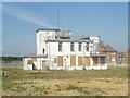
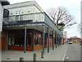
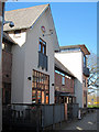
Airfield Traffic Control Building
During the Second World War, this square contained an air field. Since then, the area has been redeveloped and the air base now only remains in the name of surrounding buildings built since closure (The Spitfire, Pilot's Bistro). Geographically, this is one palpable reminder of the area's previous use - an air traffic control building, in the middle of a new housing estate. A listed building, it is believed that this building is about to be converted into a restaurant.
Image: © Hywel Williams
Taken: 10 Jul 2005
0.12 miles
4
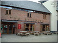
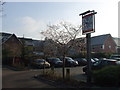
The Spitfire public house, King's Hill
Image: © Stacey Harris
Taken: 13 Mar 2010
0.12 miles
6
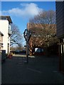
Sculpture in Liberty Square
Liberty Square on Queen Street is the shopping centre of King's Hill. Has very trend and exclusive shop and coffee bistros. White building in background is The Spitfire Pub. The sculpture is by Rick Kirby. Called "When the sky is the limit the Spirits Soar". In memory of a 'Builder of Dreams' William G. Rouse III 1942-2003.
Image: © David Anstiss
Taken: 27 Jan 2009
0.13 miles
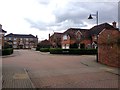
7
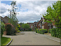
Townsend Square, Kings Hill
The name of the road, which isn't really a square in the traditional sense, but incorporates a small square area part of the way along it.
Image: © Robin Webster
Taken: 9 Jun 2012
0.13 miles
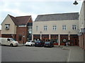
8
The Spitfire, King's Hill
A modern Shepherd Neame pub at 1 Liberty Square
Image: © Oast House Archive
Taken: 23 Mar 2011
0.13 miles