IMAGES TAKEN NEAR TO
Kings Drive, FAVERSHAM, ME13 8GS
Introduction
This page details the photographs taken nearby to Kings Drive, ME13 8GS by members of the Geograph project.
The Geograph project started in 2005 with the aim of publishing, organising and preserving representative images for every square kilometre of Great Britain, Ireland and the Isle of Man.

There are currently over 7.5m images from over14,400 individuals and you can help contribute to the project by visiting https://www.geograph.org.uk
Image Map
Images are licensed for reuse under creativecommons.org/licenses/by-sa/2.0
Notes
- Clicking on the map will re-center to the selected point.
- The higher the marker number, the further away the image location is from the centre of the postcode.
Image Listing (64 Images Found)
Images are licensed for reuse under creativecommons.org/licenses/by-sa/2.0
Image
Details
Distance
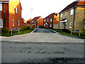
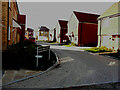
1
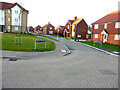
Beckett Gardens
Part of a housing estate called Kingsmead, on which 196 houses are to be built.
This was the first sunny afternoon in East Kent since 10 December.
Image: © John Baker
Taken: 21 Dec 2021
0.03 miles
2
Burbidge Fields
Part of a housing estate called Kingsmead, on which 196 houses are to be built.
Image: © John Baker
Taken: 9 Oct 2022
0.04 miles
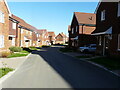
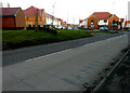
3
Kings Drive
Part of a housing estate called Kingsmead, on which 196 houses are to be built.
This was the first sunny afternoon in East Kent since 10 December.
Image: © John Baker
Taken: 21 Dec 2021
0.04 miles
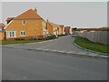
4
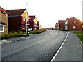
Kings Drive
Part of a housing estate called Kingsmead, on which 196 houses are to be built.
This was the first sunny afternoon in East Kent since 10 December.
Image: © John Baker
Taken: 21 Dec 2021
0.04 miles
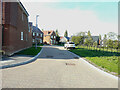
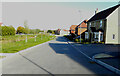
5
Chambers Lane
Part of a housing estate called Kingsmead, on which 196 houses are to be built.
This was the first sunny afternoon in East Kent since 10 December.
Image: © John Baker
Taken: 21 Dec 2021
0.04 miles
6
Chambers Lane
Part of a housing estate called Kingsmead, on which 196 houses are to be built.
This view of Image shows a bend, while this is the view beyond it after crossing Burbidge Fields.
Image: © John Baker
Taken: 9 Oct 2022
0.05 miles
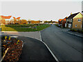
7
Kings Drive
Part of a housing estate called Kingsmead, on which 196 houses are to be built.
A similar view of Image was taken in December 2021.
The road sign named Burbridge Fields was incorrectly cast, as the correct name should be Burbidge Fields.
Image: © John Baker
Taken: 9 Oct 2022
0.05 miles
8
Marsh Lane
Part of a housing estate called Kingsmead, on which 196 houses are to be built.
This was the first sunny afternoon in East Kent since 10 December.
Image: © John Baker
Taken: 21 Dec 2021
0.07 miles
9
Logan Berry Drive
Part of a housing estate called Kingsmead, on which 196 houses are to be built.
Image: © John Baker
Taken: 9 Oct 2022
0.07 miles
10
Newly built houses, Graveney Road
The houses are part of a housing estate called Tylman Place and the road, with houses either side, is called Smedley Avenue.
This was the first sunny afternoon in East Kent since 10 December.
Image: © John Baker
Taken: 21 Dec 2021
0.08 miles