IMAGES TAKEN NEAR TO
Lower Road, FAVERSHAM, ME13 7NQ
Introduction
This page details the photographs taken nearby to Lower Road, ME13 7NQ by members of the Geograph project.
The Geograph project started in 2005 with the aim of publishing, organising and preserving representative images for every square kilometre of Great Britain, Ireland and the Isle of Man.

There are currently over 7.5m images from over14,400 individuals and you can help contribute to the project by visiting https://www.geograph.org.uk
Image Map
Images are licensed for reuse under creativecommons.org/licenses/by-sa/2.0
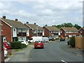
Notes
- Clicking on the map will re-center to the selected point.
- The higher the marker number, the further away the image location is from the centre of the postcode.
Image Listing (106 Images Found)
Images are licensed for reuse under creativecommons.org/licenses/by-sa/2.0
Image
Details
Distance
2
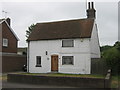
The White House, Faversham
Grade II Listed house on Lower Road.
See http://www.britishlistedbuildings.co.uk/en-438916-white-house-faversham for more details about the building.
Image: © David Anstiss
Taken: 4 Jun 2011
0.05 miles
4
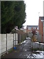
Footpath to Lower Road
This path leads from Judd Road and Hazebrouck Road to the main bus route road.
Image: © David Anstiss
Taken: 13 Jan 2010
0.07 miles
5
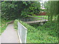
Footbridge in Faversham
This links The Knole with Beech Close. It leads over a mill stream leading to Chart Gunpowder Mill. A footpath leads along the stream toward the Mill.
Image: © David Anstiss
Taken: 20 Jun 2009
0.09 miles
7
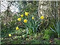
February daffodils by The Knole, Faversham
Growing on the verge of the road.
Image: © pam fray
Taken: 22 Feb 2022
0.11 miles
8
Lionfield
This curving road leads from Wellers Road to Lower Road.
Image: © David Anstiss
Taken: 17 Jan 2010
0.11 miles
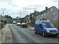
9
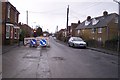
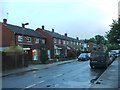
Roadworks on Lower Road, Faversham
Lower Road leads from Ospringe Road to various closes to the west of Faversham.
The road works are due to the replacement of a gas main along the road. There have been works along this road, all this year.
Image: © David Anstiss
Taken: 9 Dec 2009
0.12 miles
10
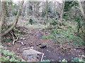
Woods near Hazebrouk Road
This block of woods is surrounded by houses. Part of the expansion of Faversham in the mid '60s. This patch of woods and ditch has survived. The drain used to be part of a watercress bed that then later fed into the Stonebridge Ponds.
The shopping trolley is an annoying reminder of the vandal element of today's youth!
Image: © David Anstiss
Taken: 25 Dec 2011
0.12 miles