IMAGES TAKEN NEAR TO
Parsonage Stocks Road, FAVERSHAM, ME13 0PN
Introduction
This page details the photographs taken nearby to Parsonage Stocks Road, ME13 0PN by members of the Geograph project.
The Geograph project started in 2005 with the aim of publishing, organising and preserving representative images for every square kilometre of Great Britain, Ireland and the Isle of Man.

There are currently over 7.5m images from over14,400 individuals and you can help contribute to the project by visiting https://www.geograph.org.uk
Image Map
Images are licensed for reuse under creativecommons.org/licenses/by-sa/2.0
Notes
- Clicking on the map will re-center to the selected point.
- The higher the marker number, the further away the image location is from the centre of the postcode.
Image Listing (10 Images Found)
Images are licensed for reuse under creativecommons.org/licenses/by-sa/2.0
Image
Details
Distance
2
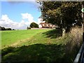
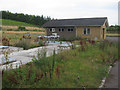
House at Parsonage Farm
Opposite the farmhouse.
Image: © Penny Mayes
Taken: 26 Sep 2006
0.08 miles
3
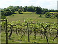
Vineyard on Parsonage Stocks Road
Between Throwley and Sheldwich. St. Michael and All Angels church is in the distance and Parsonage farm to the right.
Image: © pam fray
Taken: 20 May 2011
0.08 miles
8
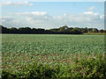
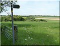
Field west of Parsonage Stocks Road
It looks like kale growing.
Image: © Robin Webster
Taken: 8 Oct 2015
0.17 miles
10
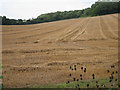
Harvested field by Bagshill Road
Image: © Oast House Archive
Taken: 19 Aug 2011
0.18 miles