IMAGES TAKEN NEAR TO
Eastchurch Road, SHEERNESS, ME12 4HN
Introduction
This page details the photographs taken nearby to Eastchurch Road, ME12 4HN by members of the Geograph project.
The Geograph project started in 2005 with the aim of publishing, organising and preserving representative images for every square kilometre of Great Britain, Ireland and the Isle of Man.

There are currently over 7.5m images from over14,400 individuals and you can help contribute to the project by visiting https://www.geograph.org.uk
Image Map
Images are licensed for reuse under creativecommons.org/licenses/by-sa/2.0
Notes
- Clicking on the map will re-center to the selected point.
- The higher the marker number, the further away the image location is from the centre of the postcode.
Image Listing (17 Images Found)
Images are licensed for reuse under creativecommons.org/licenses/by-sa/2.0
Image
Details
Distance
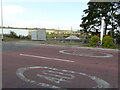
4
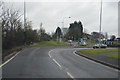
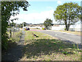
Northwest view from roundabout on B2231
On the right are a couple of derelict buildings
Image: © John Baker
Taken: 29 Sep 2012
0.10 miles
5

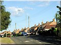
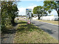
Eastchurch Village Sign
On High Street, just past roundabout with village by-pass.
Image: © David Anstiss
Taken: 22 Oct 2008
0.11 miles
6
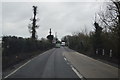
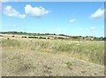
Development land, High Street
Planning permission has been granted by Swale Borough Council under application number 19/500887/FULL for the “erection of 15 dwellings with associated parking and new road access”.
The application mentions that, at present, the land is used for paddocks with stables; these are visible in this view of the Image
Image: © John Baker
Taken: 16 Sep 2021
0.14 miles
7
Development land, High Street
Planning permission has been granted by Swale Borough Council under application number 19/500887/FULL for the “erection of 15 dwellings with associated parking and new road access”.
The application mentions that, at present, the land is paddocks with stables; they are visible in this view of the Image
Image: © John Baker
Taken: 16 Sep 2021
0.14 miles
9
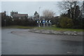
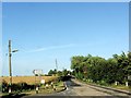
Development land, High Street
Planning permission has been granted by Swale Borough Council under application number 19/500887/FULL for the “erection of 15 dwellings with associated parking and new road access”.
The application mentions that, at present, the land is used for paddocks with stables; these may be the buildings in the distance.
Image: © John Baker
Taken: 16 Sep 2021
0.16 miles