IMAGES TAKEN NEAR TO
Russell Street, SHEERNESS, ME12 1PT
Introduction
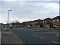
This page details the photographs taken nearby to Russell Street, ME12 1PT by members of the Geograph project.
The Geograph project started in 2005 with the aim of publishing, organising and preserving representative images for every square kilometre of Great Britain, Ireland and the Isle of Man.

There are currently over 7.5m images from over14,400 individuals and you can help contribute to the project by visiting https://www.geograph.org.uk
Image Map
Images are licensed for reuse under creativecommons.org/licenses/by-sa/2.0
Notes
- Clicking on the map will re-center to the selected point.
- The higher the marker number, the further away the image location is from the centre of the postcode.
Image Listing (131 Images Found)
Images are licensed for reuse under creativecommons.org/licenses/by-sa/2.0
Image
Details
Distance
6
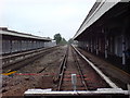
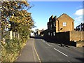
Sheerness Railway Station (1)
This is the end of the line. Trains run from here to Sittingbourne, stopping at some stations in sparsely populated places on the way.
Image: © Danny P Robinson
Taken: 26 May 2008
0.07 miles
7
Sheerness Railway Station (2)
This is the end of the line. Trains run from here to Sittingbourne, stopping at some stations in sparsely populated places on the way.
Image: © Danny P Robinson
Taken: 26 May 2008
0.07 miles
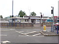
9
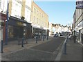
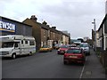
Millennium Way, Sheerness
The building to the right of William Hill, which was a Image, is now Sheerness Gateway, which provides access to a wide range of public, voluntary and community services under one roof http://www.swale.gov.uk/sheppey-gateway/
Image: © John Baker
Taken: 29 Sep 2012
0.07 miles
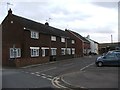
10
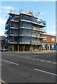
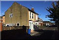
Former Victory Inn, 13, Railway Road
Planning permission was granted by Swale Borough Council under application number 17/500955/FULL for the “change of use of upper floors of former public house into 6 self-contained units. Raising of the roof height including insertion of 6 dormer windows and alterations to fenestration. Ground floor to retain A4 (drinking establishment) use (other than where access to upper floors is required). (Revised scheme to planning application 16/506715/FULL)”.
Image: © John Baker
Taken: 3 Oct 2017
0.07 miles