IMAGES TAKEN NEAR TO
Bracken Court, SITTINGBOURNE, ME10 3QG
Introduction
This page details the photographs taken nearby to Bracken Court, ME10 3QG by members of the Geograph project.
The Geograph project started in 2005 with the aim of publishing, organising and preserving representative images for every square kilometre of Great Britain, Ireland and the Isle of Man.

There are currently over 7.5m images from over14,400 individuals and you can help contribute to the project by visiting https://www.geograph.org.uk
Image Map
Images are licensed for reuse under creativecommons.org/licenses/by-sa/2.0
Notes
- Clicking on the map will re-center to the selected point.
- The higher the marker number, the further away the image location is from the centre of the postcode.
Image Listing (27 Images Found)
Images are licensed for reuse under creativecommons.org/licenses/by-sa/2.0
Image
Details
Distance
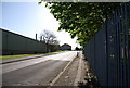
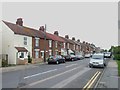
1
Mulberry Road, Great East Hall
This road leads towards the Great East Hall housing development (being built by Taylor Wimpey), from Oak Road. This entrance is only for buses (and cycles) heading towards the new houses. Cars from the estate may exit via this road. But the entrance to the estate is via Great East Hill Way (via Sittingbourne Industrial Estate).
Image: © David Anstiss
Taken: 5 Dec 2009
0.15 miles
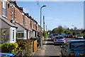
2
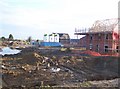
More houses for the Great East Hall Development
Seen from Mulberry Road. In front, are concrete piles in the heavy clay soils.
Then ground beams are linked into the steel of the piles, then the rest of the house foundation goes on top. In the background are three silos of mortar. On large housing estates, it is easier to bring in pre-mixed mortar for the 'brickies', instead of having a lad and a mixer.
Image: © David Anstiss
Taken: 5 Dec 2009
0.15 miles
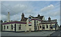
6
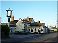
The Golden Ball Pub, Sittingbourne
On 81 Church Road.
Image: © David Anstiss
Taken: 4 Dec 2008
0.18 miles
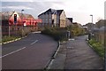
7
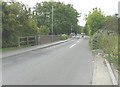
Parapet of a railway bridge
This carried Church Road over a railway, of which there is no trace today, that was used by a company called Smeed Dean, formed in 1875 for the production of bricks http://miltoncreekmemories.co.uk/bricks/ Beyond the parapet, a car is about to emerge from Sunny Bank.
Image: © John Baker
Taken: 27 Jul 2014
0.18 miles
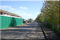
8
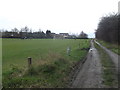
Meres Court Farm access road
This lane (and footpath) leads from the farm (near Central Park Football Ground) past a recreational ground towards Oak Road.
Image: © David Anstiss
Taken: 16 Feb 2013
0.19 miles