IMAGES TAKEN NEAR TO
Rosebery Close, SITTINGBOURNE, ME10 3DB
Introduction
This page details the photographs taken nearby to Rosebery Close, ME10 3DB by members of the Geograph project.
The Geograph project started in 2005 with the aim of publishing, organising and preserving representative images for every square kilometre of Great Britain, Ireland and the Isle of Man.

There are currently over 7.5m images from over14,400 individuals and you can help contribute to the project by visiting https://www.geograph.org.uk
Image Map
Images are licensed for reuse under creativecommons.org/licenses/by-sa/2.0
Notes
- Clicking on the map will re-center to the selected point.
- The higher the marker number, the further away the image location is from the centre of the postcode.
Image Listing (16 Images Found)
Images are licensed for reuse under creativecommons.org/licenses/by-sa/2.0
Image
Details
Distance
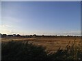
1
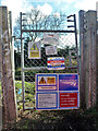
Railway access at 45 miles 76 chains
On the Victoria to Ramsgate line (VIR).
Image: © Robin Webster
Taken: 4 Apr 2015
0.05 miles
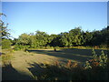
2
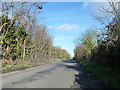
Lomas Road
The railway is just behind the hedge on the right.
Image: © Robin Webster
Taken: 4 Apr 2015
0.05 miles
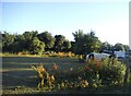
3
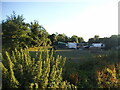
Building site on Lomas Road, Snipeshill
The housing development on the left has spread to this previous farmland.
Image: © David Howard
Taken: 17 Jul 2016
0.08 miles
4
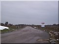
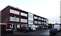
Great Easthill Way (2)
This is currently an access road for construction traffic working on the great East Hall housing development. Eventually this will be a road through the large estate. This is seen from the current housing estate, close to Mulberry Avenue.
Image: © David Anstiss
Taken: 16 Jan 2010
0.11 miles
7
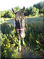
Friendly horse by Tonge Road, Snipeshill
Image: © David Howard
Taken: 17 Jul 2016
0.12 miles
8

Sittingbourne from the air
Sittingbourne in the foreground with Kingsferry Bridge and the Sheppey Crossing over Long Reach to the Isle of Sheppey beyond. The River Medway and part of the Isle of Grain can also be seen. Viewed through thin cloud from a Gatwick bound flight from Prague.
Image: © Thomas Nugent
Taken: 28 Jan 2022
0.14 miles