IMAGES TAKEN NEAR TO
Clarendon Road, MANCHESTER, M34 5GA
Introduction
This page details the photographs taken nearby to Clarendon Road, M34 5GA by members of the Geograph project.
The Geograph project started in 2005 with the aim of publishing, organising and preserving representative images for every square kilometre of Great Britain, Ireland and the Isle of Man.

There are currently over 7.5m images from over14,400 individuals and you can help contribute to the project by visiting https://www.geograph.org.uk
Image Map
Images are licensed for reuse under creativecommons.org/licenses/by-sa/2.0
Notes
- Clicking on the map will re-center to the selected point.
- The higher the marker number, the further away the image location is from the centre of the postcode.
Image Listing (62 Images Found)
Images are licensed for reuse under creativecommons.org/licenses/by-sa/2.0
Image
Details
Distance
3
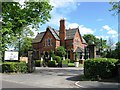
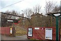
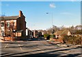
Fairfield Arms
On Manchester Road, Audenshaw.
Image: © Gerald England
Taken: 11 Feb 2010
0.08 miles
4
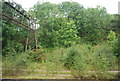
Fairfield station
Former slow lines to the left and loop to Reddish depot and Manchester Central on the right of the remaining active tracks.
Image: © Peter Whatley
Taken: 24 Mar 1989
0.09 miles
5
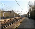
Fairfield Station
On the line from Manchester Piccadilly to Guide Bridge.
Image: © Gerald England
Taken: 21 Nov 2009
0.09 miles
6
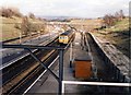
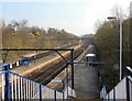
Fairfield Station
Looking East towards Guide Bridge.
Image: © Gerald England
Taken: 28 Mar 2011
0.09 miles
7
Fairfield Station
Looking East towards Guide Bridge.
Image: © Gerald England
Taken: 28 Mar 2011
0.09 miles
8
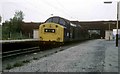
The Guide Bridge engineers trip
A Engineers trip working heads for Guide Bridge at Fairfield Station hauled by loco 40194 . After depositing the wagons at Guide Bridge the loco returned to Newton heath depot .
Image: © roger geach
Taken: 6 Jun 1984
0.10 miles
9
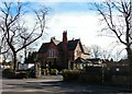
Ashton Hill Road
Leading from Audenshaw to Droylsden.
Image: © Gerald England
Taken: 11 Feb 2010
0.10 miles
10
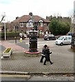
Audenshaw Trough
The junction of the B6390 and the A635. The trough Image is a former drinking trough dating from 1879, now used as a flower planter. Behind it is a former tram transformer Image erected in 1900 and renovated in 1983.
Image: © Gerald England
Taken: 28 Nov 2012
0.11 miles