Audenshaw Trough
Introduction
The photograph on this page of Audenshaw Trough by Gerald England as part of the Geograph project.
The Geograph project started in 2005 with the aim of publishing, organising and preserving representative images for every square kilometre of Great Britain, Ireland and the Isle of Man.

There are currently over 7.5m images from over 14,400 individuals and you can help contribute to the project by visiting https://www.geograph.org.uk
Audenshaw Trough
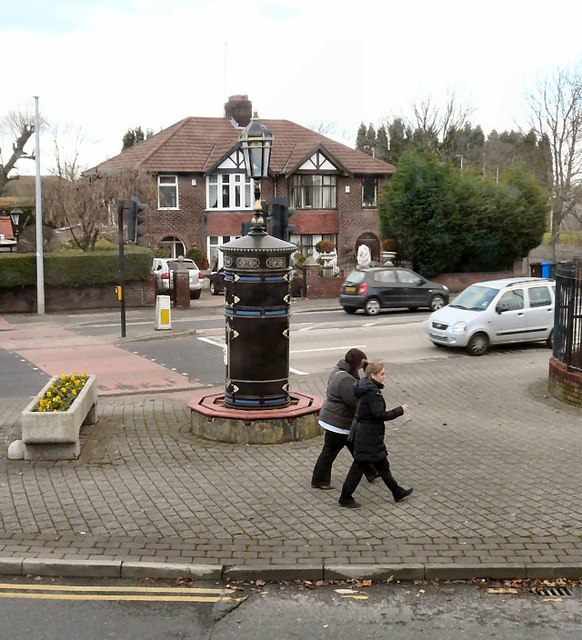
Image: © Gerald England Taken: 28 Nov 2012
The junction of the B6390 and the A635. The trough Image is a former drinking trough dating from 1879, now used as a flower planter. Behind it is a former tram transformer Image erected in 1900 and renovated in 1983.
Images are licensed for reuse under creativecommons.org/licenses/by-sa/2.0
Image Location
Latitude
53.473966
Longitude
-2.142485