
IMAGES TAKEN NEAR TO
Maple Road West, LUTON, LU4 8BQ
Introduction
This page details the photographs taken nearby to Maple Road West, LU4 8BQ by members of the Geograph project.
The Geograph project started in 2005 with the aim of publishing, organising and preserving representative images for every square kilometre of Great Britain, Ireland and the Isle of Man.

There are currently over 7.5m images from over14,400 individuals and you can help contribute to the project by visiting https://www.geograph.org.uk
Image Map
Images are licensed for reuse under creativecommons.org/licenses/by-sa/2.0
Notes
- Clicking on the map will re-center to the selected point.
- The higher the marker number, the further away the image location is from the centre of the postcode.
Image Listing (26 Images Found)
Images are licensed for reuse under creativecommons.org/licenses/by-sa/2.0
Image
Details
Distance
1
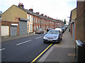
Luton: Hampton Road
Victorian terraced housing typical of the area.
Image: © Nigel Cox
Taken: 25 Jun 2006
0.05 miles
2
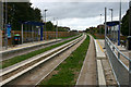
Luton & Dunstable Busway
This was taken at Clifton Road bus stop looking west along the busway tracks towards Dunstable. The busway was opened on 25th September 2013 and links various points in Dunstable and beyond with Luton Town Centre and Luton Airport. For much of its length it follows the course of a former railway that linked the two towns until its closure to passengers in 1965.
Image: © David Kemp
Taken: 26 Oct 2013
0.06 miles
3
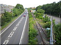
Luton: Hatters Way
The A5065 Hatters Way, the disused Luton to Dunstable railway line, and the Luton Town F.C. car park on the right, all viewed from the Clifton Road overbridge. Plans have been drawn up to use the railway trackbed for the proposed Luton Dunstable Translink scheme, website here http://www.translinkexpress.org.uk/ In the meantime advertising hoardings complete with pigeons have taken up residence.
Image: © Nigel Cox
Taken: 25 Jun 2006
0.08 miles
4
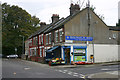
Corner shop in Bury Park, Luton
Taken on the corner of Ash Road (left) and Warwick Road East (right). The Clifton Road stop on the Guided Busway is behind the trees. Although its official entrance is off Clifton Road itself, within weeks of the Busway opening an unofficial means of access to it has been created through the trees.
Image: © David Kemp
Taken: 26 Oct 2013
0.10 miles
5
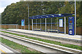
Luton & Dunstable Busway, Clifton Road stop
The busway was opened on 25th September 2013 and links various points in Dunstable and beyond with Luton Town Centre and Luton Airport. For much of its length it follows the course of a former railway that linked the two towns until its closure to passengers in 1965. There are two stops on the actual busway, Clifton Road and Stanton Road, and the Luton-bound side of the former is seen here.
Image: © David Kemp
Taken: 26 Oct 2013
0.10 miles
6
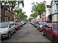
Luton: Conway Road
Looking towards Dunstable Road.
Image: © Nigel Cox
Taken: 25 Jun 2006
0.11 miles
8
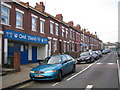
Luton: Oak Road
This late Victorian terraced housing contains one of the most unusual entrances to a league football ground in the country. Behind the blue doors are the turnstiles to the away supporters' stand at Kenilworth Road, the current home of Luton Town Football Club. The actual Kenilworth Road stand is here Image
Image: © Nigel Cox
Taken: 25 Jun 2006
0.13 miles
9
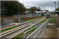
Centrebus single-decker approaching Clifton Road bus stop
Three operators serve the Luton & Dunstable Busway. One of them is Centrebus whose routes B and E link Luton Town Centre with Downside and Toddington respectively via Dunstable. The Centrebus vehicle seen here is on route B and is a Scania - East Lancs Esteem specially adapted to operate in guided form on the busway.
Image: © David Kemp
Taken: 26 Oct 2013
0.14 miles
10
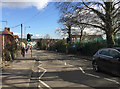
Beech Hill on Dunstable Road, Luton
One beech tree is on the right behind the high fence to a sprawling primary school. The view is towards Bury Park from halfway down this long hill.
Image: © Robin Stott
Taken: 24 Feb 2017
0.15 miles