Luton & Dunstable Busway
Introduction
The photograph on this page of Luton & Dunstable Busway by David Kemp as part of the Geograph project.
The Geograph project started in 2005 with the aim of publishing, organising and preserving representative images for every square kilometre of Great Britain, Ireland and the Isle of Man.

There are currently over 7.5m images from over 14,400 individuals and you can help contribute to the project by visiting https://www.geograph.org.uk
Luton & Dunstable Busway
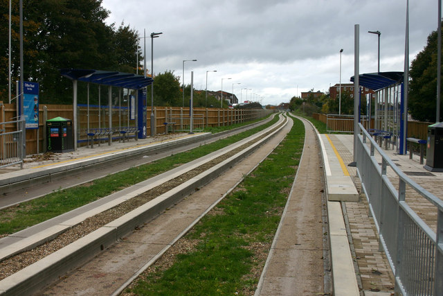
Image: © David Kemp Taken: 26 Oct 2013
This was taken at Clifton Road bus stop looking west along the busway tracks towards Dunstable. The busway was opened on 25th September 2013 and links various points in Dunstable and beyond with Luton Town Centre and Luton Airport. For much of its length it follows the course of a former railway that linked the two towns until its closure to passengers in 1965.
Images are licensed for reuse under creativecommons.org/licenses/by-sa/2.0
Image Location
Latitude
51.884626
Longitude
-0.435739