IMAGES TAKEN NEAR TO
Turners Road South, LUTON, LU2 0TG
Introduction
This page details the photographs taken nearby to Turners Road South, LU2 0TG by members of the Geograph project.
The Geograph project started in 2005 with the aim of publishing, organising and preserving representative images for every square kilometre of Great Britain, Ireland and the Isle of Man.

There are currently over 7.5m images from over14,400 individuals and you can help contribute to the project by visiting https://www.geograph.org.uk
Image Map (Loading...)


Getting Data...Please wait
Leaflet Map data © OpenStreetMap
Images are licensed for reuse under creativecommons.org/licenses/by-sa/2.0
Notes
- Clicking on the map will re-center to the selected point.
- The higher the marker number, the further away the image location is from the centre of the postcode.
Image Listing (18 Images Found)
Images are licensed for reuse under creativecommons.org/licenses/by-sa/2.0
Image
Details
Distance
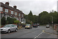
2
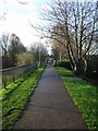
Turners Road South
Viewed from the footpath to Turners Road North.
Image: © Thomas Nugent
Taken: 26 Nov 2009
0.04 miles
3
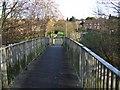
Footbridge off Turners Road North
Crosses the A505 Vauxhall Way.
Image: © Thomas Nugent
Taken: 26 Nov 2009
0.06 miles
4
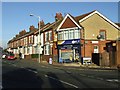
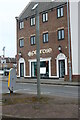
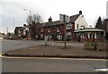
Corner shop
At the corner of Turners Road South and Ramridge Road.
Image: © Thomas Nugent
Taken: 26 Nov 2009
0.06 miles
5
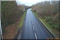
Luton: A505 Vauxhall Way
Viewed looking north westwards from the footbridge between Turners Road South and Turners Road North.
Image: © Nigel Cox
Taken: 14 Dec 2005
0.06 miles
6
Footpath off Turners Road North
Leads to a footbridge over the A505 Vauxhall Way.
Image: © Thomas Nugent
Taken: 26 Nov 2009
0.07 miles
7
Penrose estate agents on Hitchin Road, Luton
Image: © David Howard
Taken: 12 Feb 2023
0.13 miles
8
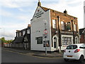
Round Green Tavern
On the A5228, where Hitchin Road becomes Stockingstone Road.
Image: © M J Richardson
Taken: 20 Sep 2017
0.13 miles
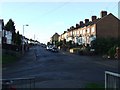
10
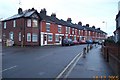
Luton: Ramridge Road
Viewed looking north westwards.
Image: © Nigel Cox
Taken: 14 Dec 2005
0.15 miles