
IMAGES TAKEN NEAR TO
Dallow Road, LUTON, LU1 1TB
Introduction
This page details the photographs taken nearby to Dallow Road, LU1 1TB by members of the Geograph project.
The Geograph project started in 2005 with the aim of publishing, organising and preserving representative images for every square kilometre of Great Britain, Ireland and the Isle of Man.

There are currently over 7.5m images from over14,400 individuals and you can help contribute to the project by visiting https://www.geograph.org.uk
Image Map
Images are licensed for reuse under creativecommons.org/licenses/by-sa/2.0
Notes
- Clicking on the map will re-center to the selected point.
- The higher the marker number, the further away the image location is from the centre of the postcode.
Image Listing (4 Images Found)
Images are licensed for reuse under creativecommons.org/licenses/by-sa/2.0
Image
Details
Distance
1
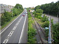
Luton: Hatters Way
The A5065 Hatters Way, the disused Luton to Dunstable railway line, and the Luton Town F.C. car park on the right, all viewed from the Clifton Road overbridge. Plans have been drawn up to use the railway trackbed for the proposed Luton Dunstable Translink scheme, website here http://www.translinkexpress.org.uk/ In the meantime advertising hoardings complete with pigeons have taken up residence.
Image: © Nigel Cox
Taken: 25 Jun 2006
0.18 miles
2
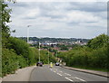
Long Croft Road
Downhill towards Luton centre.
Image: © JThomas
Taken: 3 Aug 2019
0.19 miles
3
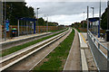
Luton & Dunstable Busway
This was taken at Clifton Road bus stop looking west along the busway tracks towards Dunstable. The busway was opened on 25th September 2013 and links various points in Dunstable and beyond with Luton Town Centre and Luton Airport. For much of its length it follows the course of a former railway that linked the two towns until its closure to passengers in 1965.
Image: © David Kemp
Taken: 26 Oct 2013
0.22 miles
4
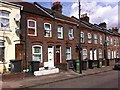
St Peters Road
Victorian terraces in Luton.
Image: © Burgess Von Thunen
Taken: 13 Aug 2013
0.24 miles