IMAGES TAKEN NEAR TO
Dolphin Court, LEEDS, LS9 8SG
Introduction
This page details the photographs taken nearby to Dolphin Court, LS9 8SG by members of the Geograph project.
The Geograph project started in 2005 with the aim of publishing, organising and preserving representative images for every square kilometre of Great Britain, Ireland and the Isle of Man.

There are currently over 7.5m images from over14,400 individuals and you can help contribute to the project by visiting https://www.geograph.org.uk
Image Map
Images are licensed for reuse under creativecommons.org/licenses/by-sa/2.0
Notes
- Clicking on the map will re-center to the selected point.
- The higher the marker number, the further away the image location is from the centre of the postcode.
Image Listing (231 Images Found)
Images are licensed for reuse under creativecommons.org/licenses/by-sa/2.0
Image
Details
Distance
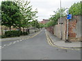
1
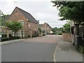
Dolphin Court - Cross Catherine Street
Image: © Betty Longbottom
Taken: 29 May 2013
0.02 miles
2
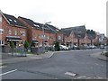
Houses on Cross Catherine Street, Leeds
Fairly recent housing. The road has a residents only parking restriction.
Image: © Stephen Craven
Taken: 12 Feb 2016
0.03 miles
3
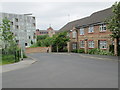
Dolphin Street - Cross Catherine Street
Image: © Betty Longbottom
Taken: 29 May 2013
0.03 miles
4
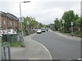
Cross Catherine Street - viewed from Wesley Place
Image: © Betty Longbottom
Taken: 29 May 2013
0.03 miles
5
East Field Street - Cross Catherine Street
Image: © Betty Longbottom
Taken: 29 May 2013
0.03 miles
6
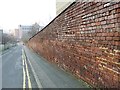
Brick wall, East Field Street, Leeds
Behind the brick wall is the Leeds-Selby railway line.
Image: © Stephen Craven
Taken: 12 Feb 2016
0.04 miles
8
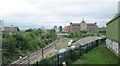
View from Bridge HUL 4/37 - Wesley Place
Image: © Betty Longbottom
Taken: 29 May 2013
0.05 miles
9
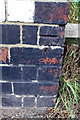
Benchmark on Wesley Place railway bridge
Ordnance Survey cut mark benchmark described on the Bench Mark Database at http://www.bench-marks.org.uk/bm50595
Image: © Roger Templeman
Taken: 6 Aug 2013
0.05 miles
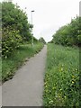
10
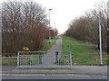
Blocked footpath, Leeds
See Image and Image showing this path in 2013 still open through to Upper Accommodation Road. By 2016 it had been blocked by a security fence. It was probably not a public right of way.
Image: © Stephen Craven
Taken: 12 Feb 2016
0.05 miles