
IMAGES TAKEN NEAR TO
Turlow Court, LEEDS, LS9 8PA
Introduction
This page details the photographs taken nearby to Turlow Court, LS9 8PA by members of the Geograph project.
The Geograph project started in 2005 with the aim of publishing, organising and preserving representative images for every square kilometre of Great Britain, Ireland and the Isle of Man.

There are currently over 7.5m images from over14,400 individuals and you can help contribute to the project by visiting https://www.geograph.org.uk
Image Map
Images are licensed for reuse under creativecommons.org/licenses/by-sa/2.0
Notes
- Clicking on the map will re-center to the selected point.
- The higher the marker number, the further away the image location is from the centre of the postcode.
Image Listing (751 Images Found)
Images are licensed for reuse under creativecommons.org/licenses/by-sa/2.0
Image
Details
Distance
1

Leeds Dam
Buildings next to the River Aire.
Image: © Wayland Smith
Taken: 26 Dec 2022
0.01 miles
2

Cranes working on Leeds Dam (3)
One of two large jib cranes working on river improvements in the city centre. For a wider view see Image
Image: © Stephen Craven
Taken: 29 Oct 2016
0.02 miles
3

Crown Point Weir
On the River Aire at Leeds.
Image: © Gerald England
Taken: 23 Apr 2009
0.02 miles
4
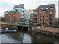
Outfall below Leeds Dam
Older maps show the Lady Beck outfalling into the Aire just above the weir, and Rick Carn's photo Image shows it still doing so (although he refers to it as the Adel Beck, which is its name further up the catchment). Engineering works prevent a view of it just now. So is this one below the dam also part of the Lady Beck or is it a different culverted stream, or perhaps just road drainage?
Image: © Stephen Craven
Taken: 18 Feb 2017
0.02 miles
5
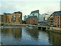
Outfall of Lady Beck
The beck (also known as Adel Beck) outfalls into the river Aire below the weir known as Leeds Dam. Looking at old maps, the original stream joined the river above the dam'; comparing Image it seems that outfall has been blocked as part of weir reconstruction, and only the lower outfall below the weir is now used.
Image: © Stephen Craven
Taken: 29 Jan 2022
0.02 miles
6

Adel Beck outflow to River Aire, Leeds
Adel Beck flows into Paul's Pond near Cookridge Hall Leeds LS16. From there into Golden Acre Park Lake (formerly Blackhill Dam), Adel Dam from where it powered Adel Mill.
It continued through Scotland Woods to power Scotland Mill (demolished) next to the current Leeds Ring Road. It flows under this and powered Smithy Mill and at the bridge on Parkside Road it becomes Meanwood Beck.
It flows down the Meanwood Valley to Sheepscar and then at Roseville Road enters a tunnel.
Image: © Rick Carn
Taken: 2 Feb 2012
0.02 miles


