
Outfall below Leeds Dam
Introduction
The photograph on this page of Outfall below Leeds Dam by Stephen Craven as part of the Geograph project.
The Geograph project started in 2005 with the aim of publishing, organising and preserving representative images for every square kilometre of Great Britain, Ireland and the Isle of Man.

There are currently over 7.5m images from over 14,400 individuals and you can help contribute to the project by visiting https://www.geograph.org.uk
Outfall below Leeds Dam
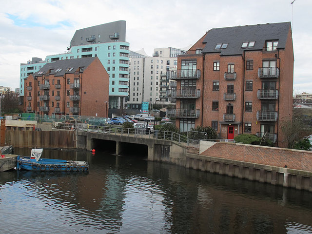
Image: © Stephen Craven Taken: 18 Feb 2017
Older maps show the Lady Beck outfalling into the Aire just above the weir, and Rick Carn's photo Image shows it still doing so (although he refers to it as the Adel Beck, which is its name further up the catchment). Engineering works prevent a view of it just now. So is this one below the dam also part of the Lady Beck or is it a different culverted stream, or perhaps just road drainage?
Images are licensed for reuse under creativecommons.org/licenses/by-sa/2.0
Image Location

Latitude
53.793211
Longitude
-1.532719