
IMAGES TAKEN NEAR TO
Richmond Hill Close, LEEDS, LS9 8JU
Introduction
This page details the photographs taken nearby to Richmond Hill Close, LS9 8JU by members of the Geograph project.
The Geograph project started in 2005 with the aim of publishing, organising and preserving representative images for every square kilometre of Great Britain, Ireland and the Isle of Man.

There are currently over 7.5m images from over14,400 individuals and you can help contribute to the project by visiting https://www.geograph.org.uk
Image Map
Images are licensed for reuse under creativecommons.org/licenses/by-sa/2.0
Notes
- Clicking on the map will re-center to the selected point.
- The higher the marker number, the further away the image location is from the centre of the postcode.
Image Listing (246 Images Found)
Images are licensed for reuse under creativecommons.org/licenses/by-sa/2.0
Image
Details
Distance
1
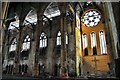
Mount St Mary's derelict interior
Mount Saint Mary's church opened in 1857 and was funded by the Irish Community. It stands in a district of Leeds traditionally known as the Bank.
The Bank had become home to a large community of Irish Catholics who had emigrated to Leeds to seek work building canals and railways.
The church was also known as the Famine Church, the original chapel was established at a time when Ireland was only beginning to recover from the Great Hunger brought on by the failure of the potato crop in successive years from 1845 to 1851. During the 1970's and 80's the congregation dwindled and the cost of keeping the church open wasn't feasible. The church closed its doors for the last time in 1989 and was de-consecrated by the Catholic church.
To see many more full size pictures of my Mount St Mary's collection see http://blog.myspace.com/index.cfm?fuseaction=blog.view&friendID=265602590&blogID=389969200
Image: © philld
Taken: 10 May 2008
0.03 miles
2
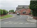
Richmond Hill Approach - Upper Accommodation Road
Image: © Betty Longbottom
Taken: 29 May 2013
0.04 miles
3
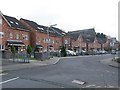
Houses on Cross Catherine Street, Leeds
Fairly recent housing. The road has a residents only parking restriction.
Image: © Stephen Craven
Taken: 12 Feb 2016
0.04 miles
4
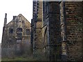
Back of former Mount St Mary's church
Seen through a gate at the top of blocked steps Image See Image for the church. The building in the background is the former presbytery, which is grade 2 listed (list entry 1255559) and also appears derelict.
Image: © Stephen Craven
Taken: 12 Feb 2016
0.05 miles
5
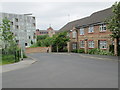
Dolphin Street - Cross Catherine Street
Image: © Betty Longbottom
Taken: 29 May 2013
0.06 miles
6
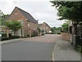
Dolphin Court - Cross Catherine Street
Image: © Betty Longbottom
Taken: 29 May 2013
0.06 miles
7
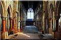
Mount St Mary's derelict interior
Mount Saint Mary's church opened in 1857 and was funded by the Irish Community. It stands in a district of Leeds traditionally known as the Bank.
The Bank had become home to a large community of Irish Catholics who had emigrated to Leeds to seek work building canals and railways.
The church was also known as the Famine Church, the original chapel was established at a time when Ireland was only beginning to recover from the Great Hunger brought on by the failure of the potato crop in successive years from 1845 to 1851. During the 1970's and 80's the congregation dwindled and the cost of keeping the church open wasn't feasible. The church closed its doors for the last time in 1989 and was de-consecrated by the Catholic church.
To see many more full size pictures of my Mount St Mary's collection see http://blog.myspace.com/index.cfm?fuseaction=blog.view&friendID=265602590&blogID=389969200
Image: © philld
Taken: 10 May 2008
0.06 miles
8
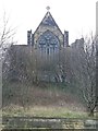
North end of former Mount St Mary's church
Originally a convent church with attached High School Image The building is listed grade 2* (list entry 1255558). Built 1852 in Gothic Revival style. Architects Joseph Hansom and W Wardell. Chancel and transepts added 1866, by Edward Welby Pugin. The church closed for worship in 1989; In 1996, it was sold to Sanctuary Housing Trust for a nominal amount. Since its sale it has remained unused but the 2015 "Heritage at Risk Register" refers to a new housing development being planned for the site. See also Image
Image: © Stephen Craven
Taken: 12 Feb 2016
0.07 miles
9
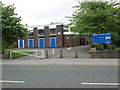
Newbourne Methodist Church - Upper Accommodation Road
Image: © Betty Longbottom
Taken: 29 May 2013
0.07 miles
10
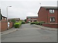
Spinney Field Court - Sussex Street
Image: © Betty Longbottom
Taken: 29 May 2013
0.07 miles