IMAGES TAKEN NEAR TO
Newton Lodge Drive, LEEDS, LS7 3DQ
Introduction
This page details the photographs taken nearby to Newton Lodge Drive, LS7 3DQ by members of the Geograph project.
The Geograph project started in 2005 with the aim of publishing, organising and preserving representative images for every square kilometre of Great Britain, Ireland and the Isle of Man.

There are currently over 7.5m images from over14,400 individuals and you can help contribute to the project by visiting https://www.geograph.org.uk
Image Map
Images are licensed for reuse under creativecommons.org/licenses/by-sa/2.0
Notes
- Clicking on the map will re-center to the selected point.
- The higher the marker number, the further away the image location is from the centre of the postcode.
Image Listing (101 Images Found)
Images are licensed for reuse under creativecommons.org/licenses/by-sa/2.0
Image
Details
Distance
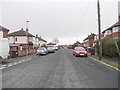
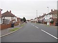
1
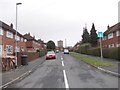
Newton Lodge Drive - St Martin's Avenue
Image: © Betty Longbottom
Taken: 29 Jan 2013
0.06 miles
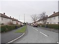
2
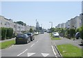
Riviera Gardens - Potternewton Lane
Image: © Betty Longbottom
Taken: 1 Jun 2009
0.06 miles
3
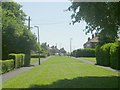
Newton Lodge Drive - Potternewton Lane
Image: © Betty Longbottom
Taken: 1 Jun 2009
0.07 miles
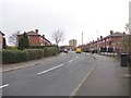
4
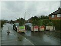
LTN planters, Scott Hall Terrace
The purpose of the planters is to create a LTN (Low Traffic Neighbourhood) by preventing through traffic on a residential street.
Image: © Stephen Craven
Taken: 2 Jan 2022
0.08 miles
5
St Martin's Avenue - viewed from St Martin's Gardens
Image: © Betty Longbottom
Taken: 29 Jan 2013
0.08 miles
6
Newton Lodge Drive - St Martin's Avenue
Image: © Betty Longbottom
Taken: 29 Jan 2013
0.09 miles
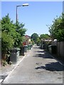
7
Scott Hall Place - Scott Hall Grove
Image: © Betty Longbottom
Taken: 29 Jan 2013
0.10 miles
8
Back Manor Grove - St Martin's Drive
Image: © Betty Longbottom
Taken: 1 Jun 2009
0.10 miles

10
St Martin's Gardens - St Martin's Avenue
Image: © Betty Longbottom
Taken: 29 Jan 2013
0.10 miles