
IMAGES TAKEN NEAR TO
Otley Road, LEEDS, LS6 2DG
Introduction
This page details the photographs taken nearby to Otley Road, LS6 2DG by members of the Geograph project.
The Geograph project started in 2005 with the aim of publishing, organising and preserving representative images for every square kilometre of Great Britain, Ireland and the Isle of Man.

There are currently over 7.5m images from over14,400 individuals and you can help contribute to the project by visiting https://www.geograph.org.uk
Image Map
Images are licensed for reuse under creativecommons.org/licenses/by-sa/2.0
Notes
- Clicking on the map will re-center to the selected point.
- The higher the marker number, the further away the image location is from the centre of the postcode.
Image Listing (276 Images Found)
Images are licensed for reuse under creativecommons.org/licenses/by-sa/2.0
Image
Details
Distance
2

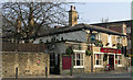
The Original Oak, Headingley
A pub in the centre of Headingley, with a large beer garden. Listed grade 2 (list entry 1375311). See also Image
Image: © Stephen Craven
Taken: 16 Aug 2016
0.02 miles
4

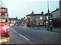
World Cup queue at The Original Oak, Headingley
This pair of photos shows the queue at the door of The Original Oak in Headingley, at 11 am on 10th June 2006, the day of England's first match in the 2006 World Cup. The match was due to kick off at 2pm. The queue stretched north along Otley Road, then turned into Shire Oak Road, and I estimated it at over 150 metres long. Three-quarters of an hour later the queue was just as long, and the pub garden had many people in it.
Apologies for the picture quality from my low-res camera phone, I didn't take my camera shopping!
Image: © Rich Tea
Taken: 10 Jun 2006
0.02 miles
5
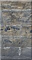
Headingley, Skyrack PH
The worn benchmark is cut into the north-east facing wall of the pub. This is the wall which faces onto Headingley Lane. The mark is cut across the 4th and 5th courses.
Image: © Mel Towler
Taken: 13 Nov 2022
0.03 miles
6
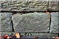
Headingley, Shire Oak Road
The benchmark is cut into the roadside wall on the south side of the road.
Image: © Mel Towler
Taken: 13 Nov 2022
0.03 miles
7
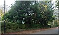
Headingley, Shire Oak Road
There is a benchmark cut into the roadside wall on the south side of the road. The cutmark is across the 1st and 2nd courses of stone.
Image: © Mel Towler
Taken: 13 Nov 2022
0.03 miles
8
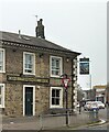
Headingley, Skyrack PH
There is a worn benchmark cut into the north-east facing wall of the pub. This is the wall which faces onto Headingley Lane. The mark is cut across the 4th and 5th courses.
Image: © Mel Towler
Taken: 13 Nov 2022
0.03 miles
9
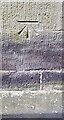
Benchmark on east face of St Michael and All Angels Church
Ordnance Survey cut mark benchmark levelled at 85.740m above Newlyn Datum verified 1957
Image: © Roger Templeman
Taken: 6 Jun 2023
0.04 miles
10
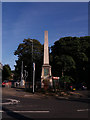
Headingley war memorial
The memorial takes the form of an obelisk at the junction of Otley Road and St Michael's Road. Listed grade 2 (list entry 1256122). See also Image
Image: © Stephen Craven
Taken: 16 Aug 2016
0.04 miles